Top Tourist Places To Visit In
| |
Uttarakhand(85 Places)
Jim Corbett National Park:
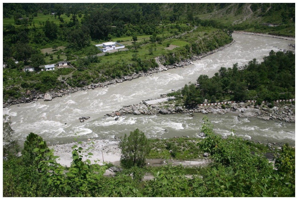
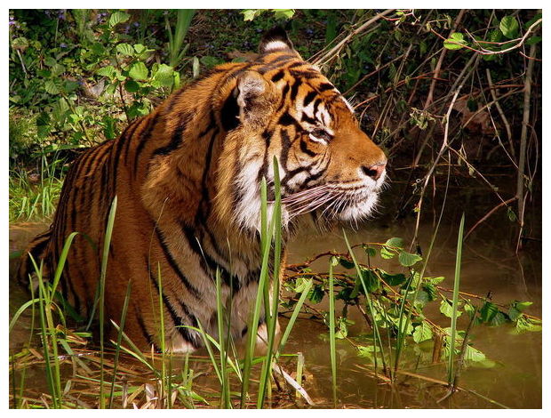
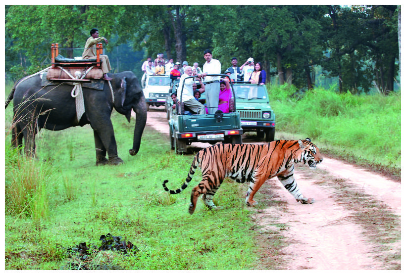 At a distance of 4 km from Ramnagar Railway Station, 65 km from Nainital, 232 km from Dehradun, and 261 km from Delhi, Jim Corbett National Park is India's oldest and most popular National Park situated in Nainital district of Uttarakhand. The Park acts as a protection zone for Bengal Tigers of India. It is one of the wellknown Uttarakhand tourist places. At a distance of 4 km from Ramnagar Railway Station, 65 km from Nainital, 232 km from Dehradun, and 261 km from Delhi, Jim Corbett National Park is India's oldest and most popular National Park situated in Nainital district of Uttarakhand. The Park acts as a protection zone for Bengal Tigers of India. It is one of the wellknown Uttarakhand tourist places.
Corbett National Park was established in 1936 as Hailey National Park. After India's independence the park was named as Ramganga National Park but later in 1956, it was renamed after Jim Corbett - the famous hunter turned conservationist and author, who played a major role in the establishment of the national park. The area came under Project Tiger in 1973. Spread over an area of about 520 sq. km, out of which 330 sq. km forms the core area, the park supports mixed deciduous and Sal forests, and Savannah grasslands. Owing to its location
The region around Chennai has served as an .....
|
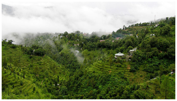
Mussoorie:
 At a distance of 33 km from Dehradun, 187 km from Ambala, 197 km from Chandigarh, 278 km from Delhi, 263 km from Shimla and 310 km from Nainital, Mussoorie is a popular hill station in Dehradun district of Uttarakhand state. This is one of the most popular hill stations in Uttarakhand and also one of the best hill stations near Delhi. Nainital is one of the wellknown Uttarakhand tourismdestinations. At a distance of 33 km from Dehradun, 187 km from Ambala, 197 km from Chandigarh, 278 km from Delhi, 263 km from Shimla and 310 km from Nainital, Mussoorie is a popular hill station in Dehradun district of Uttarakhand state. This is one of the most popular hill stations in Uttarakhand and also one of the best hill stations near Delhi. Nainital is one of the wellknown Uttarakhand tourismdestinations.
It is one of the best 2 day trip from Delhi city. Mussoorie is situated atop a horseshoe crest on the mountains of Garhwal at an average altitude of 1880 m. Mussoorie offers commanding views of the underlying Doon Valley and the magnificent Himalayas. The highest in the region is Lal Tibba in Landour, with a height of over 2,275 m. Mussoorie is called the gateway to the Yamunotri and .....
|
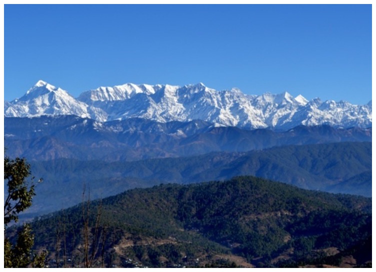
Nainital:
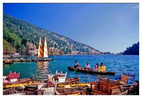 At a distance of 66 km from Ramnagar, 294 km from Delhi and 278 km from Dehradun, Nainital is a beautiful hill station in Uttarakhand and headquarters of Nainital district in the Kumaon foothills of Himalayas. It is one of the most popular hill resorts in India and also one of the top places to experience Uttarakhand tourism. It is also among the popular 2 day trip near Delhi and one of the top hill stations near Delhi. At a distance of 66 km from Ramnagar, 294 km from Delhi and 278 km from Dehradun, Nainital is a beautiful hill station in Uttarakhand and headquarters of Nainital district in the Kumaon foothills of Himalayas. It is one of the most popular hill resorts in India and also one of the top places to experience Uttarakhand tourism. It is also among the popular 2 day trip near Delhi and one of the top hill stations near Delhi.
Nainital is famous for its scenic mountain views and is commonly known as the Lake District of India. Situated at an altitude of 1938 m, Nainital derives its name from Naini Lake. The highest point is Naina Peak or China Peak, with an elevation of 2,615 m. Nainital is surrounded by mountains on three sides and the town is spread around the beautiful Naini .....
The city served as the capital of Pallava Dynasty, and most of the known temples .....
|
Almora:
 At a distance of 64 km from Nainital, 50 km from Ranikhet, 357 km from Dehradun, and 364 km from Delhi, Almora, a scenic hill station in the Almora district is a famous hill resorts in Uttarakhand. It lies at an altitude of 1,651 m, amidst the southern part of the Kumaon Hills. It is a one of the popular hill stations near Delhiand also of one of the top Tourist places in Uttarakhand. At a distance of 64 km from Nainital, 50 km from Ranikhet, 357 km from Dehradun, and 364 km from Delhi, Almora, a scenic hill station in the Almora district is a famous hill resorts in Uttarakhand. It lies at an altitude of 1,651 m, amidst the southern part of the Kumaon Hills. It is a one of the popular hill stations near Delhiand also of one of the top Tourist places in Uttarakhand.
Almora is located on a 5 km long horse shoe shaped ridge, the eastern portion of which is called the Talifat and the western one is known as Selifat. The Kosi and Suyal rivers run alongside the town adding to the beauty of the place. Almora is considered the cultural heart of the Kumaon region of Uttarakhand. The town got its name from kilmora, a short plant found in nearby region, which was used for washing the utensils of Katarmal Temple. The people .....
|
Auli:
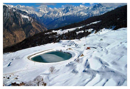 At a distance of 16 km from Joshimath, 56 km from Badrinath, 262 km from Rishikesh, 304 km from Dehradun and 495 km from Delhi, Auli is a cute hill station and an important ski destination in Chamoli district of Uttarakhand. It is one of the best ski resorts in India and one of the top Uttarakhand tourism destinations for adventure sports. At a distance of 16 km from Joshimath, 56 km from Badrinath, 262 km from Rishikesh, 304 km from Dehradun and 495 km from Delhi, Auli is a cute hill station and an important ski destination in Chamoli district of Uttarakhand. It is one of the best ski resorts in India and one of the top Uttarakhand tourism destinations for adventure sports.
Auli, also known as Auli Bugyal which means meadow in Garhwali, is located at an average altitude of 2800 m in the Garhwal Himalayas. Earlier, Auli was a prominent trade centre and the trails of Auli were frequently traversed by the semi-nomadic Bhotiya tribes who maintained barter trading with Tibet for centuries. According to legend, the revered Guru Adi Shankaracharya visited Auli during 8th century AD. He built a math at Joshimath, which still is intact and is known by the name Shankaracharya Tapastali.
Auli is also a beautiful ski destination, but .....
|
Dehradun:
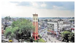 At a distance of 33 km from Mussoorie, 157 km from Chandigarh, 231 km from Delhi, 144 km from Ambala, 225 km from Shimla and 278 km from Nainital, Dehradun is the capital city of Uttarakhand and also the headquarters of Dehradun district. Dehradun is located in Doon Valley in the foothills of Himalayas nestled between two of India's mightiest rivers - the Ganges on the east and the Yamuna on the west. It is one of the wellknown destinations to experience the Tourism in Uttarakhand and also one of the popular tourist places near Delhi. At a distance of 33 km from Mussoorie, 157 km from Chandigarh, 231 km from Delhi, 144 km from Ambala, 225 km from Shimla and 278 km from Nainital, Dehradun is the capital city of Uttarakhand and also the headquarters of Dehradun district. Dehradun is located in Doon Valley in the foothills of Himalayas nestled between two of India's mightiest rivers - the Ganges on the east and the Yamuna on the west. It is one of the wellknown destinations to experience the Tourism in Uttarakhand and also one of the popular tourist places near Delhi.
The history of Dehradun city is linked to the stories of Ramayana and Mahabharata. It is believed that after the battle with Ravana, Lord Rama and his brother Laxmana visited this site. Dronacharya, the legendary Royal guru to the Kauravas and Pandavas, is believed to have been born and resided in this region. Ancient .....
|
Haridwar:
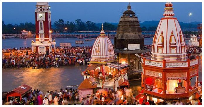 At a distance of 26 km from Rishikesh, 54 km from Dehradun, 86 km from Mussoorie, 192 km from Chandigarh and 208 km from Delhi, Haridwar or Hardwar is an ancient religious city in the Haridwar district of Uttarakhand. Haridwar is one of the best tourist Places to visit in Uttarakhand apart from being a popular pilgrimage site in India and also one of the well known tourist places near Delhi. At a distance of 26 km from Rishikesh, 54 km from Dehradun, 86 km from Mussoorie, 192 km from Chandigarh and 208 km from Delhi, Haridwar or Hardwar is an ancient religious city in the Haridwar district of Uttarakhand. Haridwar is one of the best tourist Places to visit in Uttarakhand apart from being a popular pilgrimage site in India and also one of the well known tourist places near Delhi.
Haridwar, literally translated as Gateway to God, is one of the seven holiest places for Hindus, located on the banks of River Ganges. It is the place where river Ganga descends to the plains. Haridwar is situated at an altitude of 314 m. It serves as a gateway to the Char Dham destinations of Uttarakhand which are Badrinath, Kedarnath, Gangotri and Yamunotri.
The history of Haridwar dates back .....
|
Lansdowne:
 At a distance of 40 km from Kotdwar, 131 km from Rishikesh, 106 km from Haridwar, 158 km from Dehradun and 247 km from Delhi, Lansdowne is a small hill town in Pauri Garhwal district of Uttarakhand. It lies at an elevation of 1706 m above sea level and is surrounded by thick oak and pine forests. It is one of the best hill stations in Uttarakhand state and also among wonderful hill stations for a 2 day trip from Delhi. This is also one of the popular places to experince Uttarakhand tourism. At a distance of 40 km from Kotdwar, 131 km from Rishikesh, 106 km from Haridwar, 158 km from Dehradun and 247 km from Delhi, Lansdowne is a small hill town in Pauri Garhwal district of Uttarakhand. It lies at an elevation of 1706 m above sea level and is surrounded by thick oak and pine forests. It is one of the best hill stations in Uttarakhand state and also among wonderful hill stations for a 2 day trip from Delhi. This is also one of the popular places to experince Uttarakhand tourism.
Lansdowne was a popular hill resort for the British and they built a cantonment here. Lansdowne is named after its founder Lord Lansdowne, the Viceroy of India between 1888 and 1894. Currently, the command office of the legendary Garhwal Rifles of the Indian Army is situated in Lansdowne.
Lansdowne .....
|
Kausani:
 At a distance of 37 km from Bageshwar, 58 km from Almora, 59 km from Ranikhet, 115 km from Nainital, 164 km from Pithoragarh, 241 km from Jim Corbett National Park, 318 km from Dehradun, 401 km from Delhi, Kausani is a small hill station situated in Bageshwar district of Uttarakhand, India. Situated at an altitude of 1890 m, Kausani is one of the top hill stations in Uttarakhand and also one of the prime places to visit in Uttarakhand in summer. At a distance of 37 km from Bageshwar, 58 km from Almora, 59 km from Ranikhet, 115 km from Nainital, 164 km from Pithoragarh, 241 km from Jim Corbett National Park, 318 km from Dehradun, 401 km from Delhi, Kausani is a small hill station situated in Bageshwar district of Uttarakhand, India. Situated at an altitude of 1890 m, Kausani is one of the top hill stations in Uttarakhand and also one of the prime places to visit in Uttarakhand in summer.
During ancient times, Kausani was under the administrative control of the Katyuri king, Baichaldeo. Later, he donated a large part of this land to a Gujarati Brahmin, Sri Chand Tiwari. During Independence of India in 1947, Kausani was a part of Almora district till 1997 after which Bageshwar district was carved out of Almora district.
Located atop the ridge between dense pine trees, Kausani overlooks the Someshwar valley on one side and Garur and Baijnath Katyuri valley on the other side. Described by Mahatma Gandhi himself as the 'Switzerland .....
|
Badrinath:
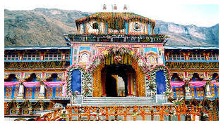 At a distance of 293 km from Rishikesh, 335 km from Dehradun and 523 km from Delhi, Badrinath is an ancient holy town in Chamoli district of Uttarakhand. It lies at an altitude of 3133 m in the Garhwal Himalayan ranges along the banks of River Alaknanda near India - Tibet border. It is one of the most famous centers of pilgrimage in India and also one of the most popular Uttarakhand places to visit as part of Char Dham. At a distance of 293 km from Rishikesh, 335 km from Dehradun and 523 km from Delhi, Badrinath is an ancient holy town in Chamoli district of Uttarakhand. It lies at an altitude of 3133 m in the Garhwal Himalayan ranges along the banks of River Alaknanda near India - Tibet border. It is one of the most famous centers of pilgrimage in India and also one of the most popular Uttarakhand places to visit as part of Char Dham.
Badrinath is the most important of the four sites of famous Char Dham pilgrimage; the other three being Puri, Dwarka and Rameshwaram. It is also visited as part of Chota Char Dham Pilgrimage along with Kedarnath, Yamunotri and Gangotri in Himalayan region of Uttarakhand. Surrounded by Nar and Narayana mountain ranges and .....
|
Gangotri:
 At a distance of 98 km from Uttarkashi, 242 km from Dehradun, 264 km from Rishikesh, 288 km from Haridwar and 483 km from Delhi, Gangotri is a popular pilgrimage town in Uttarkashi district of Uttarakhand. It is situated at an altitude of 3100 m in the Garhwal Himalayan Range on the banks of the holy Bhagirathi River. It is one of the best pilgrimage sites in Uttarakhand state and also one of the most popular Places to visit in Uttarakhand. At a distance of 98 km from Uttarkashi, 242 km from Dehradun, 264 km from Rishikesh, 288 km from Haridwar and 483 km from Delhi, Gangotri is a popular pilgrimage town in Uttarkashi district of Uttarakhand. It is situated at an altitude of 3100 m in the Garhwal Himalayan Range on the banks of the holy Bhagirathi River. It is one of the best pilgrimage sites in Uttarakhand state and also one of the most popular Places to visit in Uttarakhand.
Gangotri, the origin of the River Ganges, is one of the four sites in the Chota Char Dham pilgrimage circuit along with Badrinath, Kedarnath and Yamunotri. River Ganges originates at Gaumukh in Gangotri Glacier, which is located about 19 km away from Gangotri town. As per legends, Goddess Ganges took the form of a river in order to absolve the sins of .....
|
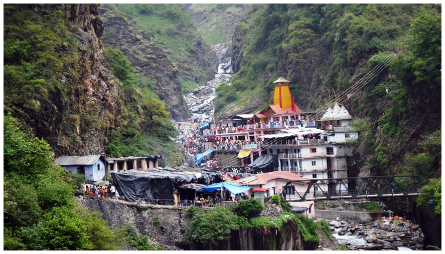
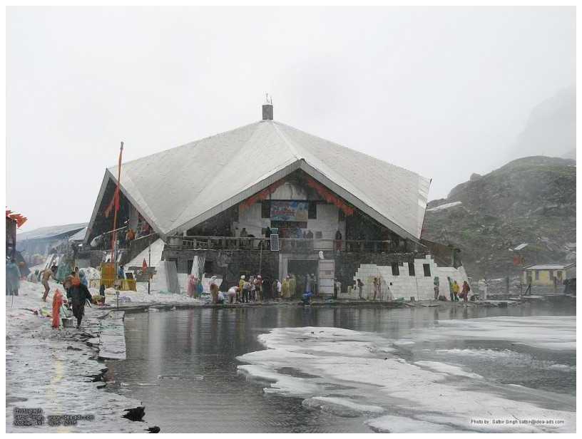
Kedarnath:
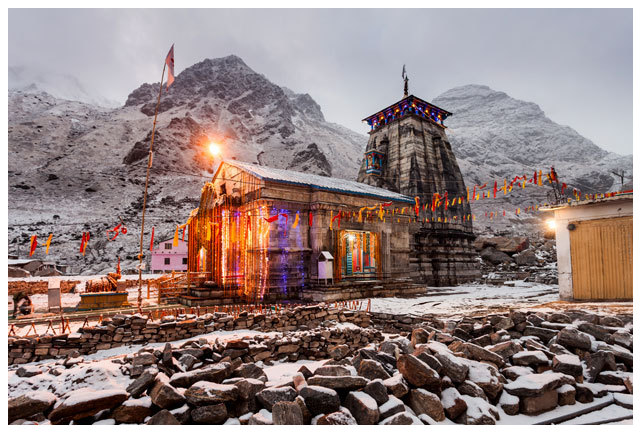 At a distance of 224 km from Rishikesh, 264 km from Dehradun and 439 km from Delhi, Kedarnath is a town and a famous center of pilgrimage in Uttarakhandsituated in Rudraprayag district. At a distance of 224 km from Rishikesh, 264 km from Dehradun and 439 km from Delhi, Kedarnath is a town and a famous center of pilgrimage in Uttarakhandsituated in Rudraprayag district.
Kedarnath is a popular pilgrimage destination for Hindus and is one of the four major Places to visit in Uttarakhand known as Chota Char Dham pilgrimage that also includes Badrinath, Gangotri and Yamunotri. It lies at an altitude of 3584 m near Chorabari Glacier, the head of river Mandakini. It is the most remote of the four Char Dham sites and is flanked by breathtaking snow-clad peaks.
Kedarnath is named after King Kedar. According to a mythology, King Kedar ruled Kedarnath during the Satya Yuga. It is believed that the temple existed even during the time of Mahabharata. It is the place where Lord .....
|
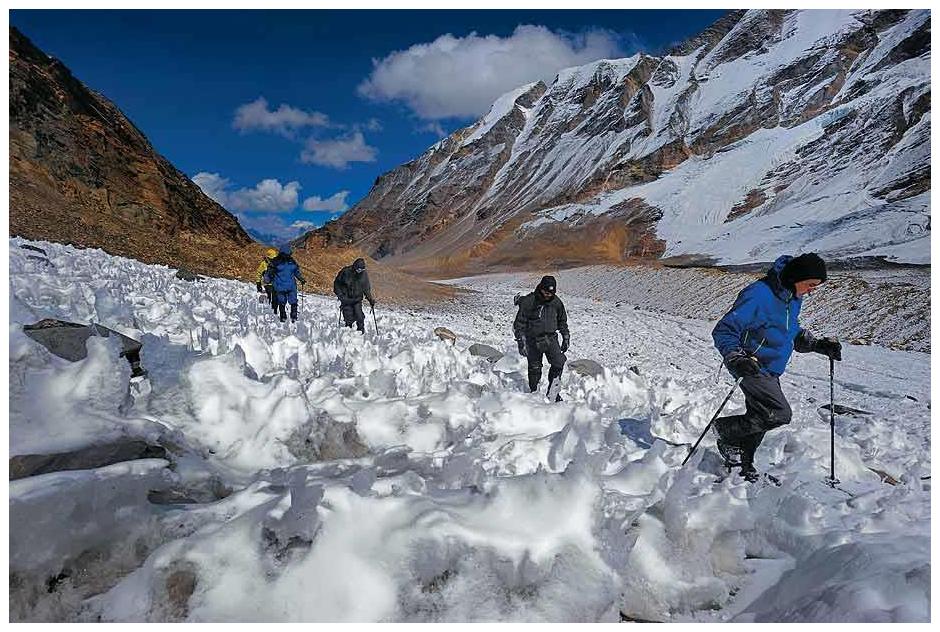
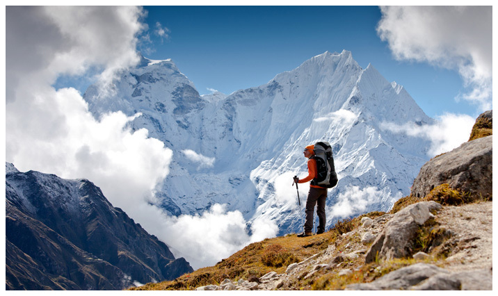
Nanda Devi National Park:
 At a distance of 26 km from Lata Village, 52 km from Joshimath, 94 km from Badrinath, 300 km from Rishikesh, 345 km from Dehradun, 327 km from Haridwar and 535 km from Delhi, Nanda Devi National Park is situated in the higher ranges of Himalayas in Chamoli district of Uttarakhand. The entire park lies at an altitude of 3,500 m and is surrounded by the Nanda Devi Mountains on three sides. It is one of the most scenic national parks in India apart from being a top trekking destination as well as one of the popular Tourist places in Uttarakhand. At a distance of 26 km from Lata Village, 52 km from Joshimath, 94 km from Badrinath, 300 km from Rishikesh, 345 km from Dehradun, 327 km from Haridwar and 535 km from Delhi, Nanda Devi National Park is situated in the higher ranges of Himalayas in Chamoli district of Uttarakhand. The entire park lies at an altitude of 3,500 m and is surrounded by the Nanda Devi Mountains on three sides. It is one of the most scenic national parks in India apart from being a top trekking destination as well as one of the popular Tourist places in Uttarakhand.
The Nanda Devi basin was declared a game sanctuary in 1939. In 1982, an area of 630.33 sq. km was added and it was declared a national park, which now forms the core zone of Nanda Devi Biosphere Reserve. Along with adjoining Valley of Flowers National Park, Nanda Devi Park was inscribed as UNESCO World Heritage Site in 2004.
Nanda .....
|
Ranikhet:
 At a distance of 50 km from Almora, 56 km from Nainital, 82 km from Haldwani, 325 km from Dehradun, and 350 km from Delhi, Ranikhet is a picturesque hill station and a cantonment town in the Almora district of Uttarakhand. Surrounded by Himalayan mountain ranges, Ranikhet is situated in the upper Kumaon Hills at an altitude of about 1869 m. It is one of the famous Tourist places in Uttarakhand and also among popular hill resorts near Delhi to visit as weekend getaway. At a distance of 50 km from Almora, 56 km from Nainital, 82 km from Haldwani, 325 km from Dehradun, and 350 km from Delhi, Ranikhet is a picturesque hill station and a cantonment town in the Almora district of Uttarakhand. Surrounded by Himalayan mountain ranges, Ranikhet is situated in the upper Kumaon Hills at an altitude of about 1869 m. It is one of the famous Tourist places in Uttarakhand and also among popular hill resorts near Delhi to visit as weekend getaway.
The word Ranikhet stands for Queen's Meadow. As per the folklore, Queen Padmini of Kumaon was so impressed with the natural beauty of this tiny hill paradise and decided to stay here. Later King Sukherdev built a palace for her at this place and named it Ranikhet.
The region around Ranikhet was ruled by local Kumaoni rulers and later came under British rule. The British developed Ranikhet as a hill station for their troops .....
|
Rishikesh:
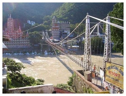 At a distance of 26 km from Haridwar, 42 km from Dehradun, 74 km from Mussoorie, 201 km from Chandigarh and 233 km from Delhi, Rishikesh is a holy city on the banks of the River Ganges and is located in the foothills of the Himalayas. It is one of the top pilgrimage sites in India and among the best places to visit near Delhi. It is also a popular 2 day trip from Delhi and is also base for several trekking trails in Uttarakhand state. At a distance of 26 km from Haridwar, 42 km from Dehradun, 74 km from Mussoorie, 201 km from Chandigarh and 233 km from Delhi, Rishikesh is a holy city on the banks of the River Ganges and is located in the foothills of the Himalayas. It is one of the top pilgrimage sites in India and among the best places to visit near Delhi. It is also a popular 2 day trip from Delhi and is also base for several trekking trails in Uttarakhand state.
Rishikesh is the gateway to the upper Garhwal region and the starting point for the Char Dham pilgrimage (Gangotri, Yamunotri, Badrinath and Kedarnath). Rishikesh is situated at an elevation of 356 m above sea level and consists of three distinct areas known as Rishikesh, Swargashram and Muni Ki Reti. Rishikesh has been a part of the legendary .....
|
Valley Of Flowers:
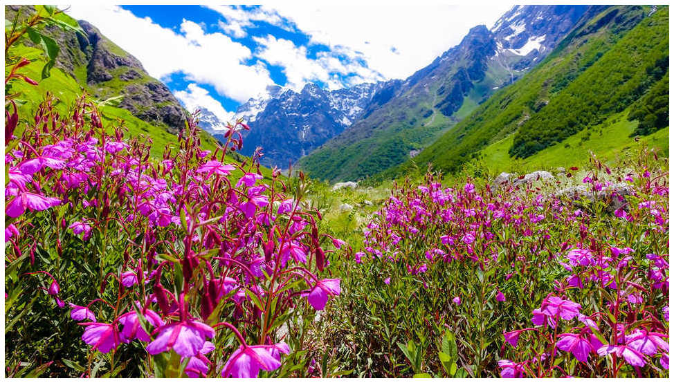 At a distance of 16 km from Govind Ghat, 34 km from Joshimath, 41 km from Badrinath, 277 km from Rishikesh, 300 km from Haridwar, 318 km from Dehradun, and 518 km from Delhi, Valley of Flowers National Park is one of the most popular tourist destinations in India located in Western Himalayas in Chamoli district of Uttarakhand. It is perched at an altitude of 3600 m and is known for its meadows of endemic alpine flowers and the variety of flora. Valley of Flowers is one of the best national parks in India and also among the best Tourist places in Uttarakhand for trekking enthuasists. At a distance of 16 km from Govind Ghat, 34 km from Joshimath, 41 km from Badrinath, 277 km from Rishikesh, 300 km from Haridwar, 318 km from Dehradun, and 518 km from Delhi, Valley of Flowers National Park is one of the most popular tourist destinations in India located in Western Himalayas in Chamoli district of Uttarakhand. It is perched at an altitude of 3600 m and is known for its meadows of endemic alpine flowers and the variety of flora. Valley of Flowers is one of the best national parks in India and also among the best Tourist places in Uttarakhand for trekking enthuasists.
Stretching over a vast expanse of 87.50 sq. km, the park is about 5 km long and 2 km wide. The gentle landscape of the Valley of Flowers complements the rugged mountain of Nanda Devi National Park to the east. Together, they encompass a unique transition .....
|
Yamunotri:
 At a distance of 46 km from Uttarkashi, 134 km from Gangotri, 138 km from Mussoorie, 176 km from Dehradun, 209 km from Rishikesh, 224 km from Haridwar and 415 km from Delhi, Yamunotri is one of the four sites of Chota Char Dham pilgrimage situated in Uttarkashi district of Uttarakhand. It is one of the best sacred pilgrimage sites in Uttarakhand state and also one of the most wellknown Places to visit in Uttarakhand. At a distance of 46 km from Uttarkashi, 134 km from Gangotri, 138 km from Mussoorie, 176 km from Dehradun, 209 km from Rishikesh, 224 km from Haridwar and 415 km from Delhi, Yamunotri is one of the four sites of Chota Char Dham pilgrimage situated in Uttarkashi district of Uttarakhand. It is one of the best sacred pilgrimage sites in Uttarakhand state and also one of the most wellknown Places to visit in Uttarakhand.
Yamunotri is the source of River Yamuna and is regarded as the seat of Goddess Yamuna. This is the western most shrine in the Garhwal Himalayas, situated at an altitude of 3293 m atop Bandarpunch parvat. Geologically, River Yamuna originates from the Champasar Glacier, which is located below Bandarpunch Mountain at an altitude of 4421 m. Champasar Glacier is about 1 km upstream from the riverbed near Yamunotri Temple but in order to reach the glacier one has to trek for .....
|
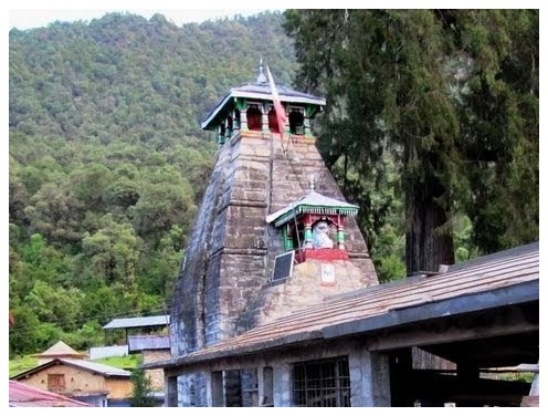
Tungnath (Near Kedarnath):
 At a distance of 3 km from Chopta, 32 km from Ukhimath, 88 km from Kedarnath, 73 km from Rudraprayag, Tungnath is one of the Panch Kedar temples and at an altitude of 3,680, it is the highest Shiva temple in the world. It is located on the Chandranath parvat in the Rudraprayag district of Uttarakhand. It is a well know pilgrimage center and also a frequented place of trekking in Uttarakhand. At a distance of 3 km from Chopta, 32 km from Ukhimath, 88 km from Kedarnath, 73 km from Rudraprayag, Tungnath is one of the Panch Kedar temples and at an altitude of 3,680, it is the highest Shiva temple in the world. It is located on the Chandranath parvat in the Rudraprayag district of Uttarakhand. It is a well know pilgrimage center and also a frequented place of trekking in Uttarakhand.
Tungnath temple is dedicated to Lord Shiva. The temple is believed to be 1000 years old and is the third in the order of the Panch Kedars. This sacred temple was discovered by Adi Shankaracharya. According to mythology, Vyas Rishi told the Pandavas that since they were culpable of slaying their own cousins during the Mahabharata war; their act could be pardoned only by Lord Shiva. Pandavas began to search Lord Shiva in the Himalayas and Lord Shiva kept avoiding them because they were guilty. In order to escape from the Pandavas, Lord Shiva disguised himself as a bull and took refuge underground. .....
|
Rudranath (Near Kedarnath):
 At a distance of 25 km from Gopeshwar, 83 km from Ukhimath and 140 km from Kedarnath, Rudranath is a pilgrimage site dedicated to Lord Shiva, situated in the Chamoli district of Uttarakhand. It lies at an altitude of 2286 m in the Garhwal Himalayan Mountains. Rudranath is the third temple to be visited in the Panch Kedar pilgrimage circuit. It is a popular pilgrimage site and also a famous place for trekking in Uttarakhand. At a distance of 25 km from Gopeshwar, 83 km from Ukhimath and 140 km from Kedarnath, Rudranath is a pilgrimage site dedicated to Lord Shiva, situated in the Chamoli district of Uttarakhand. It lies at an altitude of 2286 m in the Garhwal Himalayan Mountains. Rudranath is the third temple to be visited in the Panch Kedar pilgrimage circuit. It is a popular pilgrimage site and also a famous place for trekking in Uttarakhand.
The Rudranath temple is believed to be established by the Pandavas, the heroes of the Hindu epic Mahabharata. Legend has it that the Pandavas came to the Himalayan mountains in search of god Shiva, to redeem them of the sins of killing Kauravas in the epic Kurukshetra war. God Shiva did not wanted to meet them and escaped in form of a bull in the ground and reentered in parts in the Panch Kedar places: the hump raising in Kedarnath, the arms appearing in Tungnath, the navel and stomach surfacing in Madhyamaheshwar, the face showing up at Rudranath and the hair .....
|
Kalpeshwar Temple (Near Kedarnath):
 At a distance of 12 km from Helang, 27 km from Joshimath and 56 km from Gopeshwar & 215 km from Kedarnath, Kalpeshwar is a pilgrimage site dedicated to Lord Shiva located in the picturesque Urgam valley in Chamoli district of Uttarakhand. It lies at an altitude of 2200 m in the Garhwal Himalayas. It is a part of the famous Panch Kedars and also a good trekking route near Joshimath. At a distance of 12 km from Helang, 27 km from Joshimath and 56 km from Gopeshwar & 215 km from Kedarnath, Kalpeshwar is a pilgrimage site dedicated to Lord Shiva located in the picturesque Urgam valley in Chamoli district of Uttarakhand. It lies at an altitude of 2200 m in the Garhwal Himalayas. It is a part of the famous Panch Kedars and also a good trekking route near Joshimath.
Kalpeshwar temple is the fifth temple to be visited in the Panch Kedar pilgrimage circuit, comprising five Shiva temples in the Garhwal region. Kalpeshwar is the only Panch Kedar temple accessible throughout the year. This temple is a small stone temple and has a stone idol of Lord Shiva. Nearby the temple is a cave upon which is the image of hair locks are carved naturally. These are considered to be the hair locks of Lord Shiva that appeared in Kalpeshwar. Hence, Lord Shiva is also called as Jatadhar or Jateshwar. Kalpeshwar houses the famous Kalpavriksha. This tree is believed to fulfill all the wishes .....
|
Mayali Pass Trek (Near Kedarnath):
 At a distance of 61 km from Ghuttu village and 15 km from Kedarnath, Mayali Pass is situated at an elevation of 5300 m in Bhilangana Valley and it offers great views of Masar Tal and Vasuki Tal. Also the pass is famed for the spectacular view of Thalay Sagar, Kedar dome and other peaks of Gangotri region. At a distance of 61 km from Ghuttu village and 15 km from Kedarnath, Mayali Pass is situated at an elevation of 5300 m in Bhilangana Valley and it offers great views of Masar Tal and Vasuki Tal. Also the pass is famed for the spectacular view of Thalay Sagar, Kedar dome and other peaks of Gangotri region.
Mayali Pass is a famous place for trekking in Uttarakhand and is followed by many trekkers every year. In ancient time this trek was used by pilgrims to travel between Gangotri and Kedarnath. The Mayali Pass trek route starts from Ghuttu and the goes along Bhilangana valley. The Mayali Pass trek from Ghuttu to Gaurikund is of moderate difficulty. The trek offers an extraordinary experience of Himalayan peaks. The remote Indian villages of Gangi, Bhilangna River Catchment, Thalay Sagar peak, and Khatling glacier are the highlights of Mayali Pass trek.
Mayali Pass is approachable by two routes. One is from Ghuttu and the other is from Mala, a village right above Uttarkashi. .....
|
Vasudhara Falls (Near Badrinath):
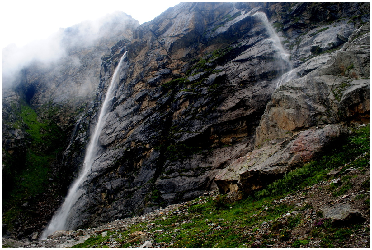 At a distance of 11.5 km from Badrinath and 6 km from Mana Village, Vasudhara Falls is one of the famous tourist attractions around Badrinath. It is one of the popular places for short trekking near Badrinath. At a distance of 11.5 km from Badrinath and 6 km from Mana Village, Vasudhara Falls is one of the famous tourist attractions around Badrinath. It is one of the popular places for short trekking near Badrinath.
Vasudhara Falls is surrounded by beautiful mountain peaks. The water of this cascading falls flows down from the height of 400 feet and is situated at an altitude of 12,000 feet. The falls is considered as a haunting site. There is a myth behind this waterfall that the water of Vasudhara Falls turns away from the visitors who are not pure at heart. From a distance, the water of the fall appears like milk flowing down the mountain.
The fall looks stunning during monsoon & post monsoon season with lush greenery and beautiful mountains around. March to June is the ideal time to visit this waterfall. Mana is accessible only when Badrinath season starts in Apr/May, so the best season to visit this place is between May and .....
|
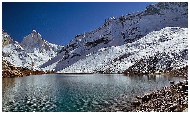
Satopanth Lake (Near Badrinath):
 At a distance of 30 km from Badrinath and 25 km from Mana, Satopanth is a mountain lake situated close to Swargarohini Peak in the Chamoli district of Uttarakhand. It is situated at an altitude of 4,600 m (15,100 feet) in Garhwal Himalayas. It is one of the well known destination for trekking in Uttarakhand. At a distance of 30 km from Badrinath and 25 km from Mana, Satopanth is a mountain lake situated close to Swargarohini Peak in the Chamoli district of Uttarakhand. It is situated at an altitude of 4,600 m (15,100 feet) in Garhwal Himalayas. It is one of the well known destination for trekking in Uttarakhand.
Satopanth is a triangular lake with three corners spread within the circumference of about a kilometer. The lake is surrounded by snow covered peaks and is named after the Hindu gods Mahesh, Vishnu and Brahma. It is believed that the divine Trinity of Brahma, Vishnu and Mahesh had meditated here and each corner of the triangular lake is named after them.
The lake is considered to be of religious significance to the local people. There is a saint known as Moni Baba, who stopped talking several years ago. There is a common belief that he can live only on sun and air, if food is unavailable. Also some unique birds are found here, which pick up the pollutants of the lake and .....
|
Swargarohini (Near Badrinath):
 At a distance of 38 km from Badrinath and 33 km from Mana, Swargarohini is a mountain range in the Saraswati Range of the Garhwal Himalayas. It lies in the Uttarkashi district of Uttarakhand, west of the Gangotri group of peaks. Swargarohini is 8 km trek from Satopanth Lake. It is one of the best trails among Uttarakhand trekking. At a distance of 38 km from Badrinath and 33 km from Mana, Swargarohini is a mountain range in the Saraswati Range of the Garhwal Himalayas. It lies in the Uttarkashi district of Uttarakhand, west of the Gangotri group of peaks. Swargarohini is 8 km trek from Satopanth Lake. It is one of the best trails among Uttarakhand trekking.
Swargarohini is a group of four peaks, of which Swargarohini I draws the attention and lies at a height of 6252 m. Swargarohini trek is the only trek which allows trekkers to go deep inside the Greater Himalayas. This trek is famous for enchanting rocky views and exhaustive conditions. Swargarohini derives its name from the legends associated with the peak which mentions that the path leads to heaven and it was followed by Pandavas & Draupadi.
The ideal time to visit Swargarohini is from May to October. The trek starts from Mana, 5 km ahead of Badrinath. The trek from Mana village to Swargarohini .....
|
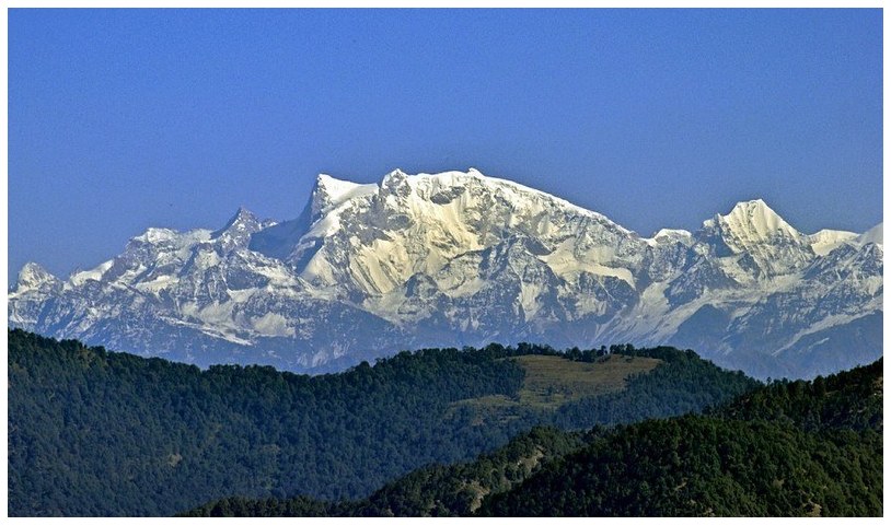
Nilkantha Peak (Near Badrinath):
 At a distance of 9 km from Badrinath, Nilkantha is a snowy peak in the shape of a pyramid near Badrinath in Chamoli district of Uttarakhand. The peak is situated at an elevation of 6,597 m above sea level. It is one of the best trekking trails in Uttarakhand. At a distance of 9 km from Badrinath, Nilkantha is a snowy peak in the shape of a pyramid near Badrinath in Chamoli district of Uttarakhand. The peak is situated at an elevation of 6,597 m above sea level. It is one of the best trekking trails in Uttarakhand.
Neelkantha, which is also known as the Garhwal Queen, is named after Lord Shiva. From a distance the peak resembles Lord Shiva sitting in meditation. It receives the first ray of Sun which glimmers the valley. Nilkantha is a major peak of the Garhwal Himalayas in the Uttarakhand region. Although substantially lower than the highest peaks of the region, it towers dramatically over the valley of the Alaknanda River and rises 3,474 m above Badrinath. Frank Smythe described the peak as second only to Siniolchu in Himalayan Beauty.
The Satopanth Glacier is on the northwest side of Nilkantha, the Panpatia Glacier remains on the southwest side and feeds Khirao Ganga, a small .....
|
Pandukeshwar (Near Badrinath):
 At a distance of 22 km from Badrinath and 21 km from Joshimath, Pandukeshwar is a sacred village in the Chamoli district of Uttarakhand. It lies at an altitude of 6300 feet and is situated on the way to Badrinath. It is a famous pilgrimage center situated between Joshimath and Badrinath. At a distance of 22 km from Badrinath and 21 km from Joshimath, Pandukeshwar is a sacred village in the Chamoli district of Uttarakhand. It lies at an altitude of 6300 feet and is situated on the way to Badrinath. It is a famous pilgrimage center situated between Joshimath and Badrinath.
According to legend, Pandukeshwar was established by King Pandu, father of great Pandavas of Mahabharata epic. He was living with his wives Kunti and Madri in Pandukeshwar after giving his throne to his elder brother Dhritharashtra. One day Pandu went on hunting in the jungle and unintentionally killed a sage making love in deer form. While the sage was dying he cursed Pandu that he will not be able make love with anyone and if he does, he will die instantly. To get cleanse of sin of killing of the sage, Pandu installed the bronze image of Vishnu in the Yogadhyan Badri shrine and mediated. Meanwhile Kunti and Madri gave birth to Pandavas through .....
|
Hemkund Sahib / Gurudwara Sri Hemkunt Sahib (Near Badrinath):
 At a distance of 18 km from Govind Ghat, 42 km from Badrinath and 36 km from Joshimath, Hemkund Sahib is a well-known Sikh shrine located in Chamoli district of Uttarakhand. It is also known as Gurudwara Hemkunt Sahib and is one among the 508 important pilgrimages for Sikhs. Situated near Valley of Flowers, it is also a popular place for trekking in Uttarakhand apart from being one of the most scenic places in Himalayas. At a distance of 18 km from Govind Ghat, 42 km from Badrinath and 36 km from Joshimath, Hemkund Sahib is a well-known Sikh shrine located in Chamoli district of Uttarakhand. It is also known as Gurudwara Hemkunt Sahib and is one among the 508 important pilgrimages for Sikhs. Situated near Valley of Flowers, it is also a popular place for trekking in Uttarakhand apart from being one of the most scenic places in Himalayas.
Gurudwara Hemkund Sahib is dedicated to Guru Gobind Singh, the tenth Sikh Guru. This gurudwara is situated at an altitude of 4329 m and is surrounded by seven snow-capped mountain peaks. This gurudwara is the world's highest gurudwara and is visited by both Sikhs as well as Hindus. It is believed that at this particular spot Guru Gobind Singh meditated for a long time. According to Hindu mythology, Rishi Medhasa of the Markandeya Purana and Lord Ram's younger brother, Lakshman, performed penance at this site.
The construction of this gurudwara started in the .....
|
Joshimath (Near Badrinath):
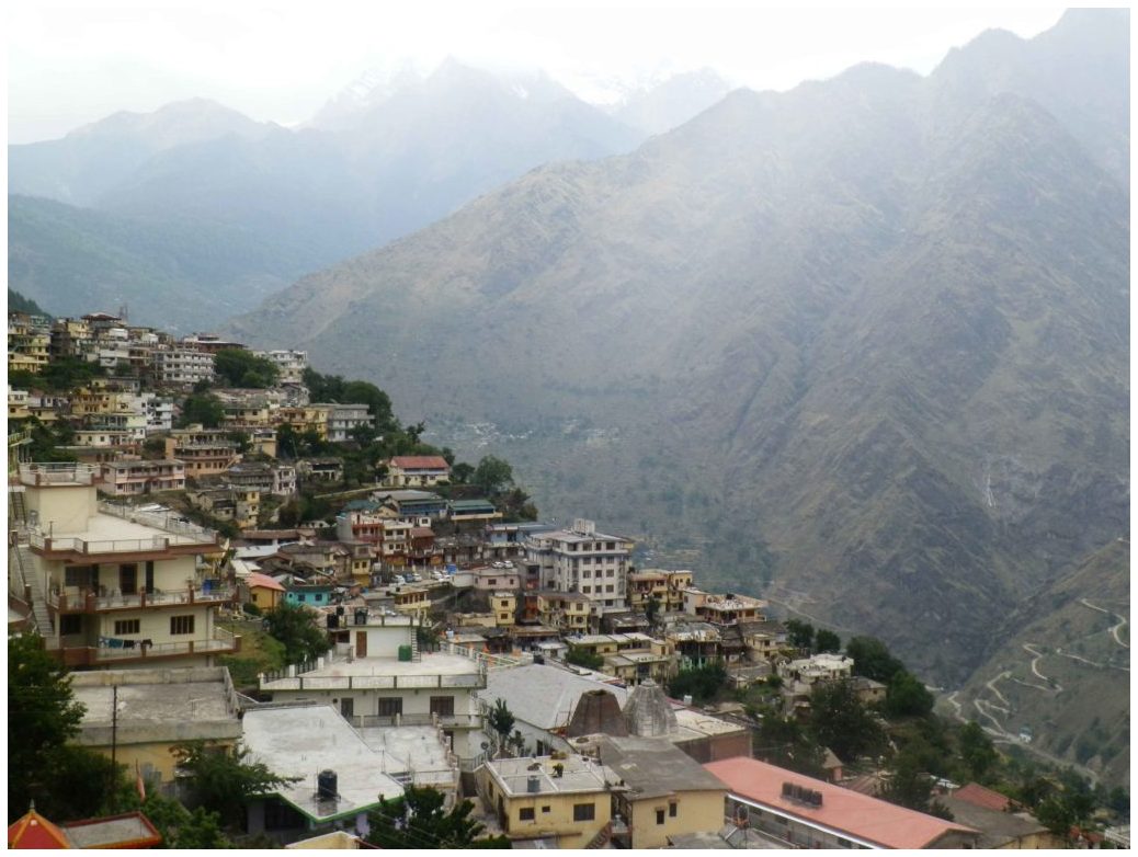 At a distance of 42 km from Badrinath, Joshimath, also known as Jyotirmath is a town and a municipal board in Chamoli district of Uttarakhand. It is situated at an altitude of 6150 feet in the snow-capped Himalayan ranges just above the mountains of Dhauliganga and Alaknanda. It is also the gateway to many Himalayan expeditions, trekking trails, camping and pilgrimage centers. At a distance of 42 km from Badrinath, Joshimath, also known as Jyotirmath is a town and a municipal board in Chamoli district of Uttarakhand. It is situated at an altitude of 6150 feet in the snow-capped Himalayan ranges just above the mountains of Dhauliganga and Alaknanda. It is also the gateway to many Himalayan expeditions, trekking trails, camping and pilgrimage centers.
Joshimath is one of the four maths or monasteries established in the 8th century by Adi Guru Sri Shankaracharya. The math here is dedicated to Atharva Veda. Joshimath lies in the region of Vishnuprayag, where two rivers of Dhauliganga and Alaknanda meet.
Joshimath is an important pilgrimage center with several temples and religious sites. Narasimha temple and Bhavishya Badri Temples are the prominent temples located in Joshimath. Narasimha Temple is an ancient temple of Lord Vishnu and main temple of Joshimath. It has idol of Lord Narasimha, which is believed to be established by Shankaracharya. As .....
|
Vishnuprayag (Near Badrinath):
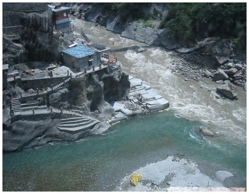 At a distance of 32 km from Badrinath and 11 km from Joshimath, Vishnuprayag is one of the Panch Prayags of Alaknanda River, and lies at the confluence of Alaknanda River and Dhauliganga River, in Chamoli district of Uttarakhand. It is a famous pilgrimage center in Uttarakhand state. At a distance of 32 km from Badrinath and 11 km from Joshimath, Vishnuprayag is one of the Panch Prayags of Alaknanda River, and lies at the confluence of Alaknanda River and Dhauliganga River, in Chamoli district of Uttarakhand. It is a famous pilgrimage center in Uttarakhand state.
The Alaknanda River, which originates in the eastern slopes of glacier fields of Chaukhamba, is joined by the Saraswathi River near Mana, and then flows in front of the Badrinath temple. It then meets the Dhauli Ganga River, which originates from the Niti Pass, to form the Vishnuprayag. This stretch of the Alaknanda River is called the Vishnu Ganga. Vishnuprayag is the first of Panch Prayag, other four being Nandaprayag, Karnaprayag, Rudraprayag and Devprayag according to descending order of river Alakananda that meets other four tributaries of holy Ganga at four different places.
Situated at an altitude of 1,372 m, Vishnuprayag derives its name .....
|
Gaumukh / Gomukh (Near Gangotri):
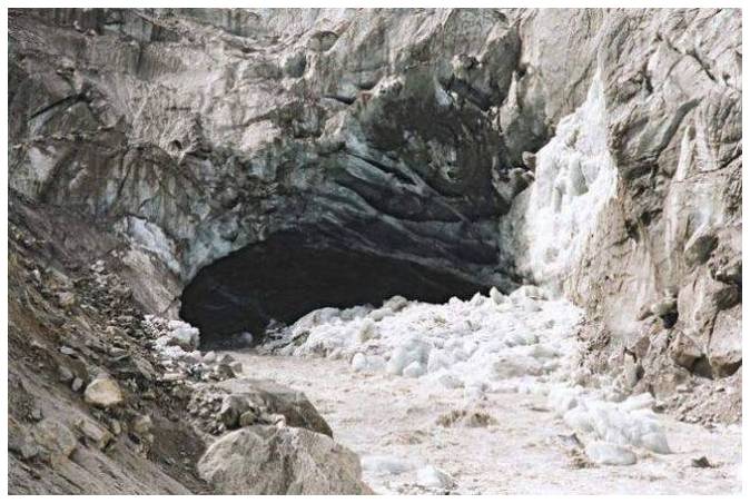 At a distance of 19 km from Gangotri, Gomukh or Gaumukh is the source of Bhagirathi River situated in Uttarkashi district of Uttarakhand. The word Gomukh literally means Face of a Cow because earlier the snout exactly looked like face of a cow. It is one of the popular pilgrimage and trekking site near Gangotri. At a distance of 19 km from Gangotri, Gomukh or Gaumukh is the source of Bhagirathi River situated in Uttarkashi district of Uttarakhand. The word Gomukh literally means Face of a Cow because earlier the snout exactly looked like face of a cow. It is one of the popular pilgrimage and trekking site near Gangotri.
Gomukh is one of the primary sources of the Ganges River. The sight of Gaumukh is incredible with Bhagirathi emerging out of an enormous cavern. The place is situated at a height of 13,200 feet and is the second largest glacier of India with 30 km in length and 4 km in width, first one being Siachen. The river is called Bhagirathi at the source and acquires the name Ganga from Devprayag onwards where it meets the Alaknanda. From Devprayag, the river flows 2,480 km to meet Bay of Bengal.
Gaumukh is a popular Hindu pilgrimage site as well as trekking destination. The Gomukh snout, due to the excessive visits of the tourists is rapidly moving backwards. According to the .....
|
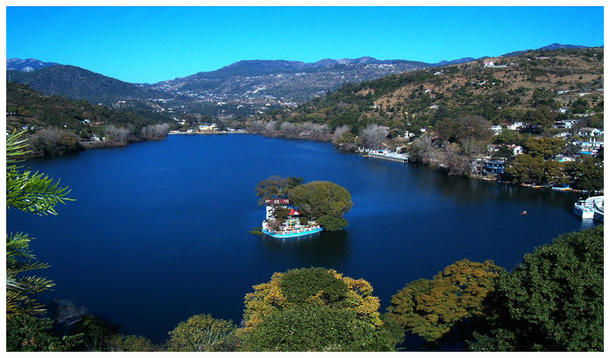
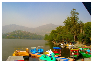
Nainital Lake / Naini Lake (Near Nainital):
At a distance of 1.5 km from Tallital Bus Stand, Nainital Lake is a natural freshwater lake, situated amidst the main town of Nainital. Nainital Lake is one of the prime places to visit in Nainital town. The lake is most commonly represented to promote Nainital Tourism.
According to the history, this lake was built in 1839 by P. Barron at an altitude of 2,000 m. This is one of the four lakes of Kumaon hills, the other three lakes are Sattal Lake, Bhimtal Lake and Naukuchiyatal Lake. Nainital Lake is lunar-shaped and has an outlet at the southeastern end. The lake covers a perimeter of 2 miles with a depth varies from 6 m to 28 m. Northern part of the lake is called as Mallital while southern part known as Tallital. Balia Nala is the main feeder-stream of the lake. Other than this, 26 major drains, including the three perennial ones, feed it. It is surrounded by panoramic hills on three sides.
According to a legend, three sages .....
|
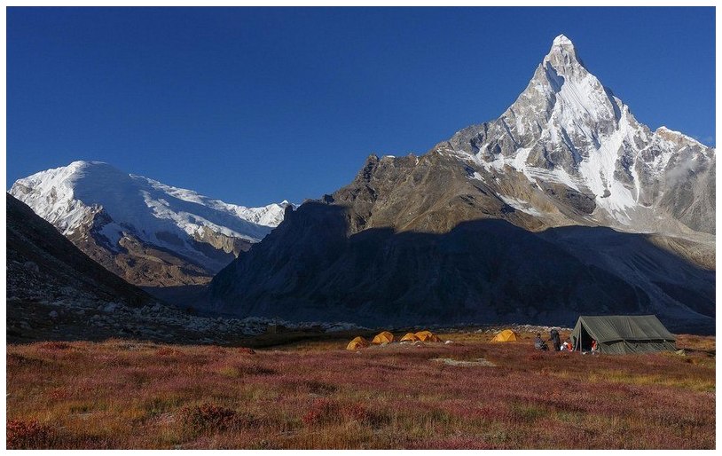
Tapovan (Near Gangotri):
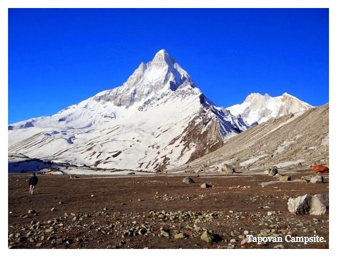 At a distance of 23 km from Gangotri, 9 km from Bhojbasa and 5 km from Gaumukh, Tapovan is an area consisting of beautiful meadows at the feet of Mt. Shivling in Uttarkashi district of Uttarakhand. It lies at an altitude of 4460 m in Garhwal Himalayas beyond Gomukh. At a distance of 23 km from Gangotri, 9 km from Bhojbasa and 5 km from Gaumukh, Tapovan is an area consisting of beautiful meadows at the feet of Mt. Shivling in Uttarkashi district of Uttarakhand. It lies at an altitude of 4460 m in Garhwal Himalayas beyond Gomukh.
Tapovan means forest of penance and as the name suggests it is actually a cold barren dry land suitable for offering penance. Tapovan area is full of meadows, streams and flowers. It is one of the most visited trails in Uttarakhand trekking. These meadows are considered as one of the best high altitude meadow in India. Tapovan area is base camp for several mountaineering expeditions including Shivling peak, Bhagirathi peak etc.
The trek to Tapovan begins from Gangotri and the trek is considered as moderate to difficult. It is a 4 day trek from Gangotri to Tapovan and back. Tapovan can be reached by two routes; the first one is the classic route which goes via Gaumukh Glacier. One has to trek 15 km to reach Bhojbasa .....
|
Nandanvan (Near Gangotri):
 At a distance of 27 km from Gangotri, 12 km from Bhojbasa and 8 km from Gaumukh, Nandanvan is a small meadow located on the base of Bhagirathi Glacier at an altitude of 4330 m past Tapovan in Uttarkashi district of Uttarakhand. At a distance of 27 km from Gangotri, 12 km from Bhojbasa and 8 km from Gaumukh, Nandanvan is a small meadow located on the base of Bhagirathi Glacier at an altitude of 4330 m past Tapovan in Uttarkashi district of Uttarakhand.
Nandanvan offers the astounding view of famous peaks like Shivling, Bhagirathi, Sudarshana, Thalay Sagar, and Kedar dome. From Gaumukh to Nandanvan, one has to trek along the Gangotri and Chaturangi glaciers. The trek is not a very tough one but needs good physical fitness. The scenic Nandanvan is the base camp for the Bhagirathi peaks that offers a panoramic view of the surrounding Shivaling peak.
The trek to Nandanvan begins from Gangotri. This is a long trek over terminal glacial moraine and steep ascents and descents. One has to trek 14 km to reach Bhojbasa from Gangotri. Gaumukh Glacier is 5 km from Bhojbasa and Nandanvan is 8 km from Gaumukh. Most of the terrain is with loose rocks that are prone to fall. The trek is considered difficult and it .....
|
Sattal / Sat Tal (Near Nainital):
 At a distance of 22 km from Nainital & 12 km from Bhimtal, Sattal or Sat Tal is a cluster of seven inter-connected freshwater lakes located in Nainital district. At an altitude of 1,370 m, it is one of the most scenic places around Nainital and also one of the popular Uttarakhand tourist places. At a distance of 22 km from Nainital & 12 km from Bhimtal, Sattal or Sat Tal is a cluster of seven inter-connected freshwater lakes located in Nainital district. At an altitude of 1,370 m, it is one of the most scenic places around Nainital and also one of the popular Uttarakhand tourist places.
The group of lakes is set amidst dense forests of oak and pine trees. Sattal is one of the few unspoiled and unpolluted fresh water bodies in India. This is often compared with Westmoreland of England by British. The names of the seven lakes of Sattal are Purna Tal, Ram Tal, Sita Tal, Laxman Tal, Nal Damyanti Tal, Sukh Tal and Garud Tal. The Garud Tal is a solitary lake and is not interconnected. The Ram, Sita and Lakshman Tal all together form the Sattal main Lake.
These lakes are heaven for migratory birds. It has 500 species of resident and migratory birds, 20 species of mammals, over .....
|
Bhimtal (Near Nainital):
 At a distance of 20 km from Nainital and 11 km from Sattal, Bhimtal is a picturesque lake located in the town of Bhimtal in Nainital district. It is situated at an altitude of 1,370 m and is one of the major places of sightseeing near Nainital. Bhimtal is older than the Nainital city as it was once part of the ancient silk route. The town and the lake are named after Bhima, one of the Pandavas of the epic story of Mahabharata who is said to have visited the place during the exile period of the Pandavas. At a distance of 20 km from Nainital and 11 km from Sattal, Bhimtal is a picturesque lake located in the town of Bhimtal in Nainital district. It is situated at an altitude of 1,370 m and is one of the major places of sightseeing near Nainital. Bhimtal is older than the Nainital city as it was once part of the ancient silk route. The town and the lake are named after Bhima, one of the Pandavas of the epic story of Mahabharata who is said to have visited the place during the exile period of the Pandavas.
Bhimtal is the largest lake in Kumaon region and situated amidst lush green mountains. The lake is of 1701 m length, 451 m width and depth of 18 m. It is spread across 63.25 hectares of area. The Victoria dam was built on this Lake in 1883 when Kumaon region was under the British Raj. Bhimtal offers splendid views and visual vistas of nature's beauty. The lake provides drinking water supply and supports aquaculture with several species .....
|
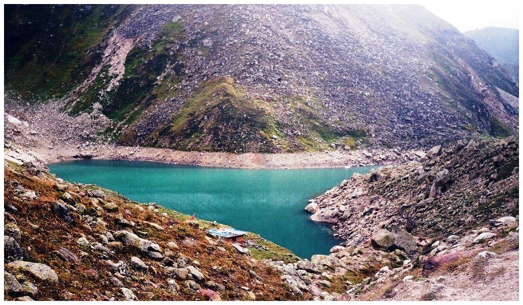
Kedartal (Near Gangotri):
 At a distance of 17 km from Gangotri, Kedartal, also known as Shiva's Lake, is a glacial lake situated in Uttarkashi district of Uttarakhand. It is one of the highest lakes in Uttarakhand, situated at an astounding altitude of 4,912 m. It is also one of the beautiful trekking routes in Uttarakhand. At a distance of 17 km from Gangotri, Kedartal, also known as Shiva's Lake, is a glacial lake situated in Uttarkashi district of Uttarakhand. It is one of the highest lakes in Uttarakhand, situated at an astounding altitude of 4,912 m. It is also one of the beautiful trekking routes in Uttarakhand.
The picturesque Kedartal is situated at the base of the Thalay Sagar and Bhrigupanth Peak. The lake is fed by the water from snow over Thalay Sagar (6,904 m), Meru (6,672 m) and Bhrigupanth (6,772m), and is the source of Kedar Ganga, an important tributary of Bhagirathi River, considered as Lord Shiva's contribution to Bhagirathi River.
Kedartal is a popular trekking destination and the trek commences from Gangotri. The Kedartal trek, being one of the moderate treks in the Garhwal Himalayan region, is recommended for trekkers having prior trekking experience. The route involves a steep rocky climb along the narrow Kedar Ganga gorge en route to Bhoj Kharak, which is 8 km from Gangotri. .....
|
Naukuchia Taal (Near Nainital):
 At a distance of 25 km from Nainital and 6 km from Bhimtal, Naukuchiatal is a picturesque lake situated in Nainital district. It is situated at an altitude of 1,220 m and it literally means nine cornered lake. At a distance of 25 km from Nainital and 6 km from Bhimtal, Naukuchiatal is a picturesque lake situated in Nainital district. It is situated at an altitude of 1,220 m and it literally means nine cornered lake.
The lake is 175 feet deep and is the deepest lake in the Nanitaal region. It is surrounded by thick vegetation of trees and shrubs. The length of lake is 983 m and breadth is 693 m. The lake is fed by an underground perennial spring.
According to mythology, any person who can spot all the nine corners of the lake standing on the ground is guaranteed nirvana. It is believed that the lake was created by Lord Brahma and a small temple dedicated to Brahma exists near the KMVN guesthouse. It is also said that anyone who performs a circumambulation of the lake will be blessed by Lord Brahma.
This place is famous for the mesmerizing beauty of terrain and green landscapes. A walk through the woods, which offers scenic .....
|
Gangotri National Park (Near Gangotri):
 At a distance of 1.5 km by trek from Gangotri, Gangotri National Park is a national park situated in the upper catchment of Bhagirathi River in Uttarkashi district of Uttarakhand. The Park falls under the bio-geographical zone and is situated at an altitude of 1800 m to 7083 m. It is one of the most beautiful high-altitude Wildlife Sanctuaries in India apart from being one of the best areas for trekking in Uttarakhand. At a distance of 1.5 km by trek from Gangotri, Gangotri National Park is a national park situated in the upper catchment of Bhagirathi River in Uttarkashi district of Uttarakhand. The Park falls under the bio-geographical zone and is situated at an altitude of 1800 m to 7083 m. It is one of the most beautiful high-altitude Wildlife Sanctuaries in India apart from being one of the best areas for trekking in Uttarakhand.
Gangotri National Park was established in 1989 and it covers an area of 2390 sq. km. The northeastern boundary of Gangotri National Park is along the international boundary with China and has various springs, waterfalls and snowy mountain peaks. The river Bhagirathi flows through the valleys inside the park, providing it the nourishment for sustaining the innumerable bird and animal species in this region. The landscape of the park is mainly dominated by alpine scrub, oak and betula.
The origin of Ganga River, known as Gaumukh, is located inside Gangotri National .....
|
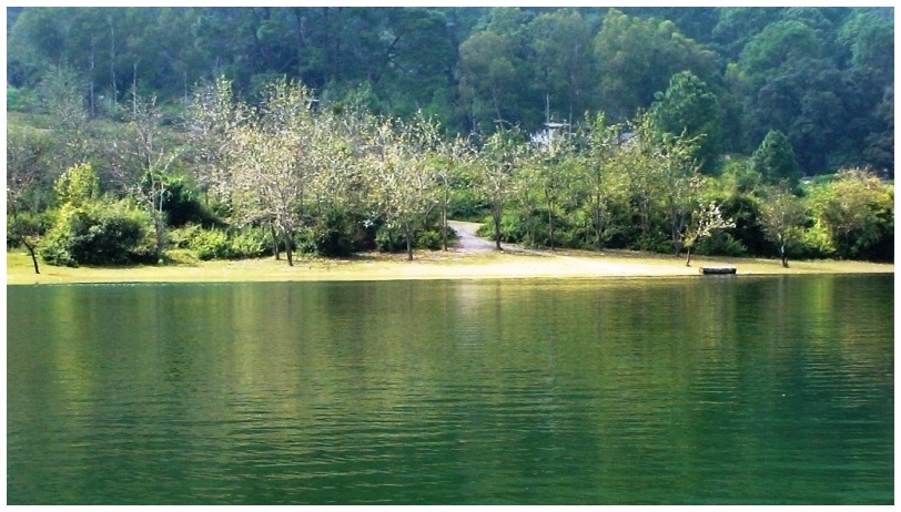
Sariyatal (Near Nainital):
 At a distance of 8 km from Tallital Bus Stand, Sariyatal is a small but beautiful lake located on Kaladungi Road in Nainital. At a distance of 8 km from Tallital Bus Stand, Sariyatal is a small but beautiful lake located on Kaladungi Road in Nainital.
Sariyatal is among the numerous lakes of Kumaon range and is fed by a beautiful stream surrounded by lush green picturesque landscape. The water of the stream is very cold. This deep emerald lake is also referred as Sarita Tal.
Apart from the beautiful lake, Sariyatal is also famous for Himalayan Botanical Garden which is run by Uttarakhand Forest Department. The Botanical Garden, spread over an area of 30 hectares, is a prominent center of study. It has a collection of several rare and endangered native plant species. This garden also has some major attractions which include an orchidarium, herbarium, Thunia Alba orchid, geodesic dome, waterfalls, etc.
Entry Ticket for Botanical Garden: Rs.20 per person.
Timings: 10 AM to 5 PM.
|
Nelong Valley (Near Gangotri):
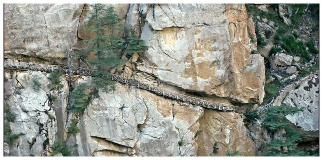 At a distance of 25 km from Bhaironghati and 34 km from Gangotri, the Nelong valley is a valley situated inside the Gangotri National Park in Uttarkashi district of Uttarakhand. The unexplored Nelong valley, situated at an altitude of around 11,000 feet, has a mountain desert landscape similar like Lahaul-Spiti and Leh-Ladakh. At a distance of 25 km from Bhaironghati and 34 km from Gangotri, the Nelong valley is a valley situated inside the Gangotri National Park in Uttarkashi district of Uttarakhand. The unexplored Nelong valley, situated at an altitude of around 11,000 feet, has a mountain desert landscape similar like Lahaul-Spiti and Leh-Ladakh.
The valley was reopened for tourists in May 2015 after a gap of 53 years. The valley had been closed to civilians since the 1962 Indo-China war, but before the war, it was the major corridor for Indo -Tibetan trade. The valley still contains some of the earlier infrastructure such as the Gartang Galion wooden bridge and the Lal Devta temple. The valley offers a panoramic view of the Tibetan plateau. Apart from the charming landscapes, Nelong Valley is also home to some of the important wildlife species like snow leopard, Himalayan blue sheep and musk deer.
The valley can be approached from Bhaironghati, located about 90 km away from Uttarkashi town. From .....
|
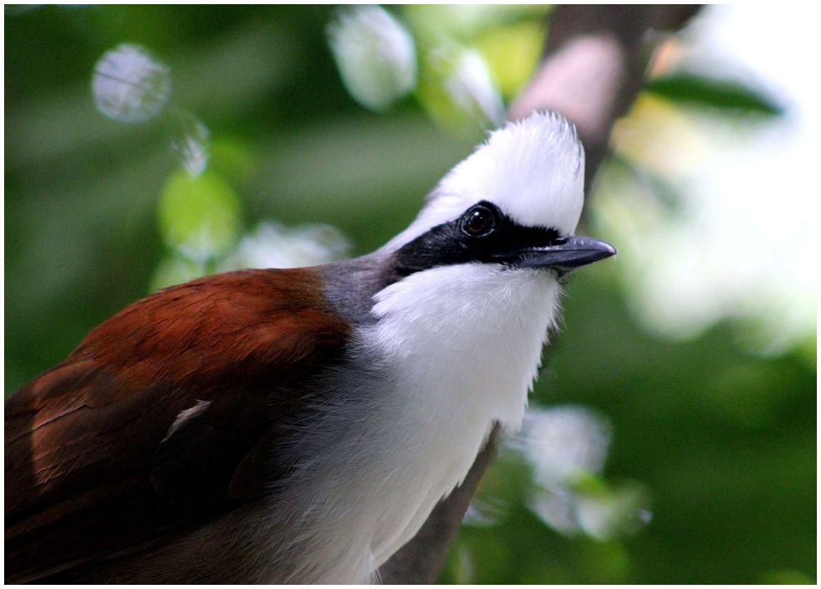
Pangot And Kilbury Bird Sanctuary (Near Nainital):
 At a distance of 15 km from Tallital Bus Stand and 3 km from Pangot, Pangot and Kilbury Bird Sanctuary is a bird watcher's paradise on Kilbury road in NainitalDistrict. This is famous for numerous bird species and is located at an altitude of 2528 m. At a distance of 15 km from Tallital Bus Stand and 3 km from Pangot, Pangot and Kilbury Bird Sanctuary is a bird watcher's paradise on Kilbury road in NainitalDistrict. This is famous for numerous bird species and is located at an altitude of 2528 m.
Kilbury is surrounded by lush dense forest of oak, pine and rhododendron which provides ample opportunities for bird watching. One of the India's scenic and famous birding routes, Kilbury is known for more than 580 species of birds. Both migratory and local birds can be spotted in the region. The most commonly found birds are the Brown wood Owls, White- throated laughing thrushes, Collared Grosbeaks, and Fork tails. The Sanctuary is situated in the reserve forest of Nainital. The place is calm and serene and the occasional sounds made by birds are just pleasant to the ears.
The place is located midst mountains and a driving to this place is exciting. A lot of Mammals can be .....
|
Saptrishi Kund (Near Yamunotri):
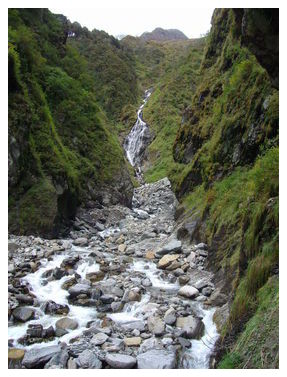 At a distance of 10 km from Yamunotri Temple, Saptarishi Kund is the original source of Yamuna River fed by Champasar Glacier situated in the upper parts of the massif created by Bandarpunch Mountain. It is an ideal place for trekking near Yamunotrifor 2-3 days. At a distance of 10 km from Yamunotri Temple, Saptarishi Kund is the original source of Yamuna River fed by Champasar Glacier situated in the upper parts of the massif created by Bandarpunch Mountain. It is an ideal place for trekking near Yamunotrifor 2-3 days.
Saptrishi Kund is about a half km in diameter, and its water is dark blue in color, The water of the nearby glaciers gathers in this lake. On the banks of Saptrishi Kund Lake, there are naturally created slate stones. The rare Brahma Lotus grows here. It is believed that seven great Rishis Kasyapa, Atri, Bharadwaj, Viswamitra, Gautama, Jamadagni, and Vasistha performed penance at Saptrishi Lake in ancient times.
The Saptrishi Kund is located amidst magnificent and enchanting surroundings of the lofty rock strewn glaciers. This scenic spot lies at an altitude of 4421 m. Trek to Saptrishi Kund is considered to be one of the most difficult treks in the Himalayas. The .....
|
Corbett Falls (Near Nainital):
 At a distance of 38 km from Nainital, 5 km from Kaladhungi and 26 km from Ramnagar, Corbett Waterfalls is situated on Ramnagar - Kaladhungi highway in Nainital district. At a distance of 38 km from Nainital, 5 km from Kaladhungi and 26 km from Ramnagar, Corbett Waterfalls is situated on Ramnagar - Kaladhungi highway in Nainital district.
Corbett Falls is a scenic water fall and is surrounded by dense teak wood forest. This waterfall is cascading down from a height of 20 m in to a pool. Sound of the waterfall makes perfect melody with chippings of the birds. The fall is not very huge and bathing in the falls is no longer permitted, but the natural beauty around the place has to be enjoyed and appreciated.
Trekking in the forests, bird watching and nature walks are popular activities around Corbett Falls. There are no shops or stalls, so visitors need to carry their own food and water.
Corbett Waterfall can be reach by hiring taxi or bus from Kaladhungi or Ramnagar. Visitors have to take small trek of 1.5 km from main road to reach Corbett Falls or one has to drive from the main road .....
|
Bali Pass Trek (Near Yamunotri):
 At a distance of 9 km from Yamunotri, Bali Pass Trek is one of the least explored treks in the Indian Himalayan region that connects Har Ki Dun Valley with Yamunotri. It is one of the best and tough treks in Uttarakhand. At a distance of 9 km from Yamunotri, Bali Pass Trek is one of the least explored treks in the Indian Himalayan region that connects Har Ki Dun Valley with Yamunotri. It is one of the best and tough treks in Uttarakhand.
Bali Pass is situated at an elevation of about 4,800 m in the Garhwal Himalayan region and was an old route from the Tons river valley to the Yamuna river valley. It continues to attract trekkers during the monsoon season when the snow melts and the pass is approachable. The pass is more approachable from the Har Ki Dun valley as the gradient is small.
The Bali Pass trek commences from Sankri, which is approximately 153 km from Mussoorie and 130 km from Yamunotri by road. The trekking trail stretches for approximately 7-8 days with elevation ranging from 1,900 m to 4,800 m, passing through the charming Har Ki Dun valley. The trail runs through Govind National Park, which houses several colorful orchards, .....
|
Ramgarh (Near Nainital):
 At a distance of 34 km from Nainital and 28 km from Mukteshwar, Ramgarh is a small hill station in Uttarakhand state and popular place to visit in Nainital district. Situated on the way to Mukteshwar, this place is famous for orchards. At a distance of 34 km from Nainital and 28 km from Mukteshwar, Ramgarh is a small hill station in Uttarakhand state and popular place to visit in Nainital district. Situated on the way to Mukteshwar, this place is famous for orchards.
Ramgarh is divided in two parts known as Malla located on elevation and Talla located downhill. This is situated at an average elevation of 1518 m above sea level. Ramgarh is away from the hustle bustle of the city offering pristine environment and gigantic view of the Himalayas.
This hill station is founded by British and was frequently visited by many high profile personalities of India and British. The place was once the cantonment of the English army. The hill station carries the legacy of some ancestral buildings, used as inspection bungalows and temporary palaces for officers dating back to British colonial period.
|
Barkot (Near Yamunotri):
 At a distance of 50 km from Yamunotri and 61 km from Uttarkashi, Barkot is a hill town located on the banks of the Yamuna River in Uttarkashi district of Uttarakhand. Situated at an elevation of 1220 m above sea level, Barkot is one of the popular places of tourism in Uttarakhand state. At a distance of 50 km from Yamunotri and 61 km from Uttarkashi, Barkot is a hill town located on the banks of the Yamuna River in Uttarkashi district of Uttarakhand. Situated at an elevation of 1220 m above sea level, Barkot is one of the popular places of tourism in Uttarakhand state.
Barkot is known for its scenic beauty and offers panoramic views of the snow-capped mountains of Bandarpunch and other beautiful mountain peaks of the Himalayas. Barkot is an important stopover en route Yamunotri and Gangotri, among the four Chota Char Dham pilgrimages. It is an ideal holidaying and adventure destination as the place offers many trekking excursions and white water rafting opportunities. The ravishing landscapes, gushing water of the sacred Yamuna River and apple orchards attract the tourists in large number.
|
Kainchi Dham (Near Nainital):
 At a distance of 17 km from Nainital and 8 km from Bhowali, Kainchi Dham is a religious pilgrimage center located at Kainchi on the Nainital - Almora Road in Uttarakhand. The word Kainchi means two sharp hairpin bends in a local dialect and hence the name. It is one of the well known temples of Uttarakhand state. Famous visitors of the temple include Apple founder Steve Jobs and Facebook founder Mark Zuckerberg. At a distance of 17 km from Nainital and 8 km from Bhowali, Kainchi Dham is a religious pilgrimage center located at Kainchi on the Nainital - Almora Road in Uttarakhand. The word Kainchi means two sharp hairpin bends in a local dialect and hence the name. It is one of the well known temples of Uttarakhand state. Famous visitors of the temple include Apple founder Steve Jobs and Facebook founder Mark Zuckerberg.
Kainchi is a beautiful secluded shrine and is famous for the Hanuman Mandir. The ashram is situated at an altitude of 1400 m. In 1962, Neem Karoli Baba built a platform around a place where two spiritual gurus Sadhu Premi Baba and Sombari Maharaj had performed Yagyas in Kainchi village. The Hanuman temple was later built over the platform thus establishing the Kainchi Ashram. The first temple of Lord Hanuman was inaugurated in June 15, 1964 by Neem Karoli Baba.
|
Tarkeshwar Mahadev Temple (Near Lansdowne):
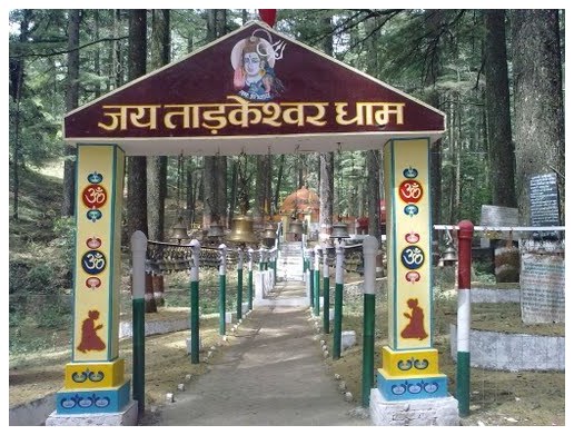 At a distance of 37 km from Lansdowne and 69 km from Kotdwar, Tarkeshwar Mahadev Temple is an ancient temple situated in the Pauri Garhwal district of Uttarakhand. Located atop a hill at an elevation of 2092 m, Tarkeshwar Mahadev Temple is believed to be one of the ancient holy sites known as Siddha Piths dedicated to Lord Shiva. It is one of the famous temples of Uttarakhand state. At a distance of 37 km from Lansdowne and 69 km from Kotdwar, Tarkeshwar Mahadev Temple is an ancient temple situated in the Pauri Garhwal district of Uttarakhand. Located atop a hill at an elevation of 2092 m, Tarkeshwar Mahadev Temple is believed to be one of the ancient holy sites known as Siddha Piths dedicated to Lord Shiva. It is one of the famous temples of Uttarakhand state.
|
Binsar Mahadev Mandir (Near Ranikhet):
 At a distance of 18 km from Ranikhet, Binsar Mahadev Mandir is an ancient Hindu temple situated at Bisaona near Ranikhet in Uttarakhand. The temple is surrounded by thick deodar forests and lies at an altitude of 2480 m. This is among the most visited temples in Uttarakhand. At a distance of 18 km from Ranikhet, Binsar Mahadev Mandir is an ancient Hindu temple situated at Bisaona near Ranikhet in Uttarakhand. The temple is surrounded by thick deodar forests and lies at an altitude of 2480 m. This is among the most visited temples in Uttarakhand.
The Binsar Mahadev Temple is dedicated to Lord Shiva worshipped here as Bindeshwar. The temple was built in 10th century by King Pithu in memory of his father Bindu, hence this temple is also known as Bindeshwar temple. The temple also houses the idols of Lord Ganesha, Goddess Gauri and Goddess Mahisasuramardini. The idol of Mahisasuramardini is engraved with texts in Nagarilipi which dates back to as early as the 9th century.
|
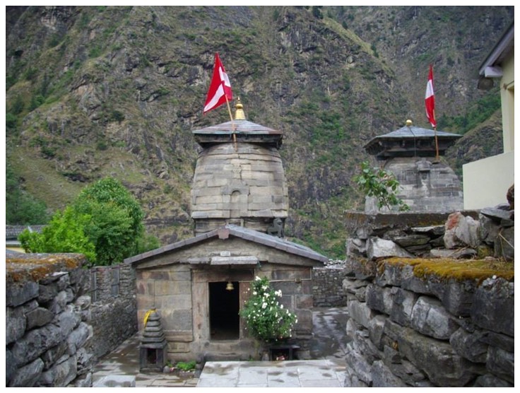
Katarmal Sun Temple (Near Almora):
 At a distance of 20 km from Almora and 30 km from Ranikhet, Katarmal Sun Temple is an ancient Hindu temple situated at Katarmal village in Almora district of Uttarakhand. At a distance of 20 km from Almora and 30 km from Ranikhet, Katarmal Sun Temple is an ancient Hindu temple situated at Katarmal village in Almora district of Uttarakhand.
Katarmal Temple is dedicated to Lord Burhadita or Vriddhaditya (the old Sun God) and is one of the famous historical places of Kumaon hills in Uttarakhand. The present image of Surya in the temple dates back to 12th century. Built in the 9th century by Katarmalla, a Katyuri king, this temple is perched at an altitude of 2116 m.
|
Dwarahat (Near Ranikhet):
 At a distance of 34 km from Ranikhet & 77 km from Almora, Dwarahat is an ancient town situated in Almora district of Uttarakhand. It is famous for its ancient temples which were constructed mainly by the Katyuri kings and are maintained by ASI. At a distance of 34 km from Ranikhet & 77 km from Almora, Dwarahat is an ancient town situated in Almora district of Uttarakhand. It is famous for its ancient temples which were constructed mainly by the Katyuri kings and are maintained by ASI.
Dwarahat, which means Way to Heaven, was once the principal seat of the Katyuri kings whose empire was stretched from the Sutlez River in the west to river Gandak in the east, and from the Himalayas to the plains, including the whole of Rohelkhand. Later it came under the rule of the Chand Rajas of Kumaon in the sixteenth century.
|
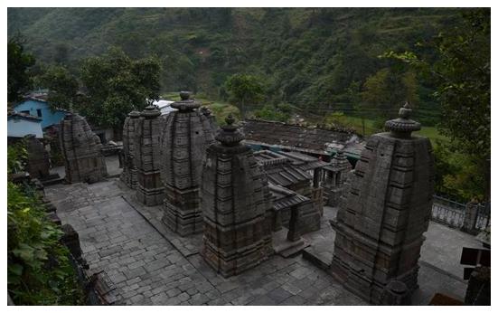
Jageshwar Dham (Near Almora):
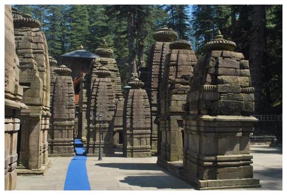 At a distance of 37 km from Almora, Jageshwar is a Hindu pilgrimage town in Almora district of Uttarakhand. It is located at an altitude of 1870 m on the banks of Jataganga River. At a distance of 37 km from Almora, Jageshwar is a Hindu pilgrimage town in Almora district of Uttarakhand. It is located at an altitude of 1870 m on the banks of Jataganga River.
Jageshwar was once the center of Lakulish Shaivism (Lakulish is 28th Avatar of Shiva). Origin and history of Lakulish (Shiva with a wooden stick) traverse back to Gujarat region of current India. The temple city comprises a cluster of 124 large and small temples with many preserved by the Archaeological Survey of India, which include Dandeshwar Temple, Chandi Temple, Jageshwar Temple, Kuber Temple, Mritunjaya Temple, Nanda Devi or Nava Durga, Nava-grah temple, a Pyramidal shrine, and Surya Temple, amongst which the oldest shrine is the Mrityunjaya Temple and the biggest shrine is the Dandeshwar Temple.
|
Binsar Wildlife Sanctuary (Near Almora):
 At a distance of 26 km from Almora, Binsar Wildlife Sanctuary is located in the foothills of Himalayas in Almora district of Uttarakhand. At a distance of 26 km from Almora, Binsar Wildlife Sanctuary is located in the foothills of Himalayas in Almora district of Uttarakhand.
Binsar wildlife sanctuary was declared in the year 1988. This reserve forest is located at an altitude of 2270 m and it covers an area of 47.04 sq. km. The peak point known as Jhandi Dhar is at an elevation of 2412 m. Apart from protecting wildlife, the sanctuary was established with an aim to conserve the broad leaf oak forests, mainly located in the Central Himalayan region.
Binsar was the summer capital of the Chand Kings, who ruled Kumaon from the 11th to 18th centuries. During British rule there was a base at Almora and during summer Binsar was used as official summer capital. There are 5 villages inside the sanctuary and 30 villages on the boundary of the sanctuary.
|
Bhavishya Badri Temple (Near Auli):
 At a distance of 23 km from Joshimath and 35 km from Auli, Bhavishya Badri, also spelt as Bhabisya Badri, is situated near Subhain village of Niti Valley on the way to Lata from Tapovan in Uttarkashi district of Uttarakhand. At a distance of 23 km from Joshimath and 35 km from Auli, Bhavishya Badri, also spelt as Bhabisya Badri, is situated near Subhain village of Niti Valley on the way to Lata from Tapovan in Uttarkashi district of Uttarakhand.
Bhavishya Badri is one of Panch Badri temples located at a height of 2744 m above sea level. The presiding deity of this small temple is Lord Narsimha, an incarnation of Lord Vishnu and known to be the future seat of Badrinath. According to the legend of Bhavishya Badri, at the end of Kali Yuga, a landslide will occur collapsing Nara and Narayan hills and blocking the path to Badrinath. This devastating landslide will occur when the right arm of the statue of Narasimha currently situated in Joshimath detaches from its body. Then, Badrinath will appear at the Bhavishya Badri temple and be worshipped here, instead of the Badrinath shrine.
|
Kuari Bugyal / Kuari Pass (Near Auli):
 At a distance of 20 km from Auli, 27 km from Joshimath, 21 km from Tapovan & 17 km from Gurson Bugyal, Kuari Bugyal is a famous meadow known for untouched beauty of Himalayas situated at an altitude of 3350 m. It is well known for one of the famous trekking trails in Uttarakhand, Kuari Pass Trek. At a distance of 20 km from Auli, 27 km from Joshimath, 21 km from Tapovan & 17 km from Gurson Bugyal, Kuari Bugyal is a famous meadow known for untouched beauty of Himalayas situated at an altitude of 3350 m. It is well known for one of the famous trekking trails in Uttarakhand, Kuari Pass Trek.
Kuari Bugyal is perfect place for trekking. During summer season, tourists throng to this place to explore the trekking trails of this beautiful region. Lord Curzon made the trek to Kuari Pass, and since than it has come to known as Curzon's trail. It is very popular among European and American travelers.
|
Nandaprayag (Near Auli):
 At a distance of 20 km from Chamoli Gopeshwar, 23 km from Karnaprayag, 74 km from Auli and 60 km from Joshimath, Nandaprayag is a town and a nagar panchayat in Chamoli district of Uttarakhand. Situated at an altitude of 870 m, it is a well known places of pilgrimage in Uttarakhand state. At a distance of 20 km from Chamoli Gopeshwar, 23 km from Karnaprayag, 74 km from Auli and 60 km from Joshimath, Nandaprayag is a town and a nagar panchayat in Chamoli district of Uttarakhand. Situated at an altitude of 870 m, it is a well known places of pilgrimage in Uttarakhand state.
Nandaprayag is one of the Panch Prayagas of Alaknanda River, and lies at the confluence of Alaknanda River and Nandakini River. Nandaprayag, Vishnuprayag, Karnaprayag, Rudraprayag and Devprayag form the Panch Prayagas. The source of Alaknanda River is Satopanth near Badrinath Dham and Nandakini River is emerging from the foot of the Nanda Devi Peak. It is believed that a holy dip in the confluence of Nandaprayag washes all the sins.
|
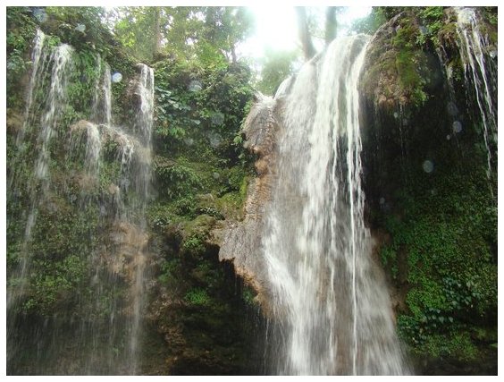
Kempty Falls (Near Mussoorie):
 At a distance of 14.5 km from Mussoorie Library Bus Stand and 48 km from Dehradun, Kempty Fall is a fascinating waterfall and one of the best tourist places to visit in Mussoorie. This fall is located on Mussoorie-Yamunotri Road. Kempty Falls is one of the best waterfalls in Uttarakhand and also among the top waterfalls in India. It is most often represented to promote Mussoorie Tourism and also one of the wellknown Uttarakhand tourist places. At a distance of 14.5 km from Mussoorie Library Bus Stand and 48 km from Dehradun, Kempty Fall is a fascinating waterfall and one of the best tourist places to visit in Mussoorie. This fall is located on Mussoorie-Yamunotri Road. Kempty Falls is one of the best waterfalls in Uttarakhand and also among the top waterfalls in India. It is most often represented to promote Mussoorie Tourism and also one of the wellknown Uttarakhand tourist places.
Kempty Falls was developed as a tourist destination by a British officer John Mekinan, around 1835. The name of the place is derived from Camp-tea, the place where Britishers organized tea parties during colonial period.
|
Bhatta Falls (Near Mussoorie):
 At a distance of 10.5 km from Mussoorie Library Bus Stand, Bhatta Falls is situated on Mussoorie - Dehradun Road near Bhatta Village. This fall is one of the major tourist attractions and also among the best waterfalls in Mussoorie. At a distance of 10.5 km from Mussoorie Library Bus Stand, Bhatta Falls is situated on Mussoorie - Dehradun Road near Bhatta Village. This fall is one of the major tourist attractions and also among the best waterfalls in Mussoorie.
Bhatta Falls is a natural waterfall cascading down from a height of 30 feet into a naturally encircled pool. This waterfall is relatively untouched by commercialization and a good place to spend some time. Visitors can see several picturesque locations ideal for photographer to catch nature at its best. The pond at bottom of the falls provides some opportunity for swimming. There is also a children's park, slopes and swings are provided for playing purpose.
Bhatta Falls is easily accessible by car or bus from Mussoorie and Dehradun. The falls about 100 meters from parking area and can be reached through well laid steps.
|
Benog Wildlife Sanctuary (Near Mussoorie):
 At a distance of 12 km from Library Bus Stand, Benog Wildlife Sanctuary has is a bird-watching haven and a part of famous Rajaji National Park. The sanctuary is set amidst densely wooded forests and is regarded as one of the top tourist destinations in Mussoorie. At a distance of 12 km from Library Bus Stand, Benog Wildlife Sanctuary has is a bird-watching haven and a part of famous Rajaji National Park. The sanctuary is set amidst densely wooded forests and is regarded as one of the top tourist destinations in Mussoorie.
Benog Wildlife Sanctuary, also known as Vinog Mountain Quail Sanctuary, was established in the year 1993. This beautiful sanctuary, spreading across an expanse of about 339 hectares, is a heaven for birdwatchers. It is located in a pine-clad slope and is surrounded by snowcapped peaks of the Himalayan ranges.
|
Snow Adventure Zone (Near Mussoorie):
 At a distance of 21 km from Library Bus Stand and 6 km from Dhanaulti, Snow Adventure Zone is an adventure park situated at Buranskhanda on Mussoorie - Dhanaulti road. It was earlier known as Mussoorie Adventure Park and was located near Cloud's End. It was recently moved to the current location with wide range of additional activities. It is one of the best places to experience adventure activities in Uttarakhand. At a distance of 21 km from Library Bus Stand and 6 km from Dhanaulti, Snow Adventure Zone is an adventure park situated at Buranskhanda on Mussoorie - Dhanaulti road. It was earlier known as Mussoorie Adventure Park and was located near Cloud's End. It was recently moved to the current location with wide range of additional activities. It is one of the best places to experience adventure activities in Uttarakhand.
|
Bhadraj Temple Trek (Near Mussoorie):
 At a distance of 18.5 km from Library Bus Stand, Bhadraj Temple is located on the western region of Mussoorie at Bhadraj. It is an ideal spot for trekking and is also known as the milkman's trail in Mussoorie. At a distance of 18.5 km from Library Bus Stand, Bhadraj Temple is located on the western region of Mussoorie at Bhadraj. It is an ideal spot for trekking and is also known as the milkman's trail in Mussoorie.
Bhadraj temple is dedicated to Lord Bal Bhadra, brother of Lord Krishna. This temple is situated atop a hill and offers a splendid view of the Doon Valley, Chakrata ranges and the Jaunsar Bawar area of Himalayas. Every year Bhadraj temple organizes a fair from 15th to 17th of August which attracts thousands of devotees who seek blessings from Lord Bhadraj. The devotees offer milk and butter to the idol of the deity.
Bhadraj temple can be reached by 11 km trek from Clouds End. The trail passes through Dudhli village (3 km) from where the temple is 8 km trek. The terrain close to the summit is covered with thick forest of oak trees. There are multiple trails to reach the temple from Dudhli village.
|
Dhanaulti (Near Mussoorie):
 At a distance of 27 km from Mussoorie, Dhanaulti is a hill station situated on Mussoorie - Chamba Road in the Tehri district of Uttarakhand. Dhanaulti is emerging as a popular weekend getaway from Delhi and also an ideal hill resort in Uttarakhandstate. At a distance of 27 km from Mussoorie, Dhanaulti is a hill station situated on Mussoorie - Chamba Road in the Tehri district of Uttarakhand. Dhanaulti is emerging as a popular weekend getaway from Delhi and also an ideal hill resort in Uttarakhandstate.
|
Lakhamandal (Near Mussoorie):
 At a distance of 75 km from Mussoorie and 68 km from Chakrata, Lakha Mandal is an ancient Hindu temple complex situated in the Jaunsar - Bawar region of Dehradundistrict. This monument has been declared as a monument of national importance by ASI. It is one of the famous heritage sites in Uttarakhand. At a distance of 75 km from Mussoorie and 68 km from Chakrata, Lakha Mandal is an ancient Hindu temple complex situated in the Jaunsar - Bawar region of Dehradundistrict. This monument has been declared as a monument of national importance by ASI. It is one of the famous heritage sites in Uttarakhand.
The Lakha Mandal temple is dedicated to Lord Shiva. The temple is surrounded by beautiful mountains and Yamuna River. Lakhamandal gets its name from the two words, lakha meaning many and mandals meaning temples. This temple is popular among the Shakti Cult, who believes that a visit to this temple shrine will end their misfortunes.
|
Tiger Falls - Chakrata (Near Dehradun):
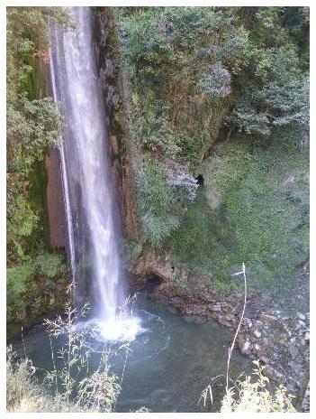 At a distance of 111 km from Dehradun, 105 km from Mussoorie and 26 km from Chakrata, Tiger Falls is a magnificent waterfall located amidst hilly terrain near Chakrata in Uttarakhand. Tiger fall is also known as Keraao Pachad and Kailu Pachad in local languages. At a distance of 111 km from Dehradun, 105 km from Mussoorie and 26 km from Chakrata, Tiger Falls is a magnificent waterfall located amidst hilly terrain near Chakrata in Uttarakhand. Tiger fall is also known as Keraao Pachad and Kailu Pachad in local languages.
At an elevation of 1395 m above the sea level, this waterfall cascades down from a height of 50 meters. The waters of this majestic fall are collected in a small pond. Visitors can enjoy a rejuvenating bath in the pond. Tiger Falls is a favorite attraction for the people of Chakrata and surrounding region.
During monsoon Tiger fall can be seen in its full glory. Tiger fall could be approached by a 25 km road drive on Chakrata - Lakhamandal route followed by 1 km trek. Alternatively, travellers can take 5 km trek from Chakrata through forest to reach Tiger Falls. The trekking route takes the travellers through the dense forests with rhododendron and oak trees.
|
Chakrata (Near Dehradun):
 At a distance of 87 km from Dehradun, 98 km from Mussoorie and 43 km from Kalsi, Chakrata is a beautiful town in Dehradun district. It is situated between the Tons and Yamuna rivers, at an elevation of 2118 m. It was originally a cantonment town during British rule. The town, enclosed between Kinnaur in the west and Mussooriein the east, is known for its beautiful and serene location. It is one of the popular summer destinations in Uttarakhand state. At a distance of 87 km from Dehradun, 98 km from Mussoorie and 43 km from Kalsi, Chakrata is a beautiful town in Dehradun district. It is situated between the Tons and Yamuna rivers, at an elevation of 2118 m. It was originally a cantonment town during British rule. The town, enclosed between Kinnaur in the west and Mussooriein the east, is known for its beautiful and serene location. It is one of the popular summer destinations in Uttarakhand state.
The town was earlier known as Jaunsar Bawar, belonging to the Jaunsari tribes. The cantonment of British Indian Army was established here in 1866 by Colonel Hume of the 55th Regiment and the troops first occupied the cantonment in April 1869. This place was a summer retreat for officials of the English East India Company.
|
Rajaji National Park (Near Haridwar):
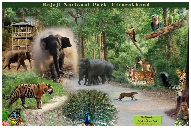 At a distance of 8 km from Haridwar, 21 km from Rishikesh & 55 km from Dehradun, Rajaji National Park is a Tiger Reserve situated at the edge of the sprawling Dehradun Valley. The park is spread over an area of 820.42 sq. km. in Dehradun, Haridwar & Pauri Garhwal districts of Uttarakhand. At a distance of 8 km from Haridwar, 21 km from Rishikesh & 55 km from Dehradun, Rajaji National Park is a Tiger Reserve situated at the edge of the sprawling Dehradun Valley. The park is spread over an area of 820.42 sq. km. in Dehradun, Haridwar & Pauri Garhwal districts of Uttarakhand.
Motichur Wildlife Sanctuary, which covers about 90 sq. km, was carved out of Dehradun forests in the year 1966. Similarly, Rajaji Wildlife Sanctuary was formed from the Shivalik forests and Chilla Wildlife Sanctuary from the Landsowne forests in 1967 and 1974 respectively. The Rajaji National Park was established by merging these three wildlife sanctuaries and named Rajaji National Park in the year 1983 after the famous freedom fighter and the last Governor-General of India Sri C. Rajagopalachari, popularly known as Rajaji.
|
Baijnath (Near Kausani):
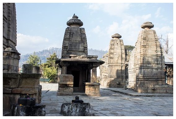 At a distance of 17 km from Kausani and 21 km from Bageshwar, Baijnath is a small ancient town situated on the banks of the Gomti River in Bageshwar district of Uttarakhand, India. Baijnath is most noted for its ancient temples and is one of the top places to visit in Kausani. At a distance of 17 km from Kausani and 21 km from Bageshwar, Baijnath is a small ancient town situated on the banks of the Gomti River in Bageshwar district of Uttarakhand, India. Baijnath is most noted for its ancient temples and is one of the top places to visit in Kausani.
Once known as Kartikyapura, Baijnath was the capital of the Katyuri kings who ruled Uttaranchal during 12th and 13th centuries AD. Baijnath is famous for Baijnath Temple which is devoted to Lord Shiva. Baijnath Temple was constructed during the 12th century and as per the legend Lord Shiva and Parvati were married here at the confluence of River Garur Ganga and River Gomti. The temple is approached from the riverside by a flight of steps made of stones constructed by the orders of a Katyuri queen.
|
Bagnath Temple - Bageshwar (Near Kausani):
 At a distance of 38 km from Kausani and 21 km from Baijnath Temple, Bagnath Temple is an ancient temple situated in the town of Bageshwar at the confluence of Sarayu and Gomti Rivers. It is one of the famous pilgrimage places in Uttarakhand and also one of the prime places to visit in Kausani. At a distance of 38 km from Kausani and 21 km from Baijnath Temple, Bagnath Temple is an ancient temple situated in the town of Bageshwar at the confluence of Sarayu and Gomti Rivers. It is one of the famous pilgrimage places in Uttarakhand and also one of the prime places to visit in Kausani.
The Bagnath temple is dedicated to Lord Shiva. Some sources state that the existence of Bagnath temple since 7th Century and the present building in nagara style was built in 1450 AD by Chand ruler, Laxmi Chand. The various statues in the temple date back from 7th century AD to 16th century AD.
The town Bageshwar has derived its name from the temple of Lord Shiva. According to legend, Bagnath temple is the place where Sage Markandeya worshipped Lord Shiva. Pleased with his prayers Lord Shiva manifested in Tiger avatar and blessed Markandeya. The significance of the temple finds mention in the Skanda Purana.
|
Rudradhari Falls & Temple (Near Kausani):
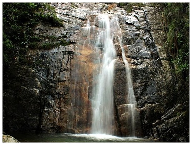 At a distance of 10 km from Kausani Bus Stop, Rudradhari Falls & Temple are located at Kantali Village on Kausani - Almora Road, Uttarakhand. It is one of the popular places to visit in Kausani and also one of the top places of trekking in Kausani. At a distance of 10 km from Kausani Bus Stop, Rudradhari Falls & Temple are located at Kantali Village on Kausani - Almora Road, Uttarakhand. It is one of the popular places to visit in Kausani and also one of the top places of trekking in Kausani.
The Rudradhari waterfall is a natural location with lush green paddy fields where water flows over a vertical drop in the course of a river. This waterfall can be easily watched while trekking to Adi Kailash region or Trishul parvat. There are many ancient caves which have been explored near the water fall. The caves are natural and very impressive with green mountains and a natural environment around.
|
Pindari Glacier Trek (Near Kausani):
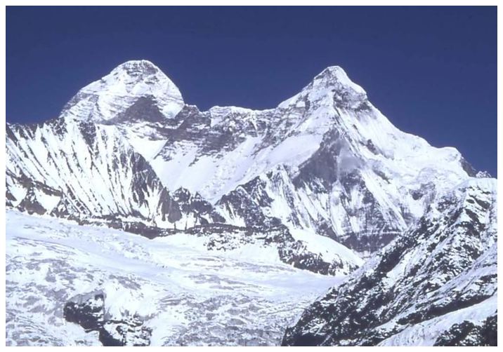 At a distance of 120 km from Kausani and 80 km from Bageshwar, Pindari Glacier is a glacier found in the upper reaches of the Kumaon Himalayas, to the southeast of Nanda Devi, Nanda Kot. It is one of the most easily accessible of all the Himalayan glaciers and also one of the top places of trekking in Uttarakhand. At a distance of 120 km from Kausani and 80 km from Bageshwar, Pindari Glacier is a glacier found in the upper reaches of the Kumaon Himalayas, to the southeast of Nanda Devi, Nanda Kot. It is one of the most easily accessible of all the Himalayan glaciers and also one of the top places of trekking in Uttarakhand.
The glacier flows to the south for a short distance of about 3 km, 0.25 km in breadth and gives rise to the Pindari River which meets the Alakananda at Karnaprayag in Garhwal district. The Pindari trek offers serenity and tranquility along with the spectacular mountain scenery. It lies between the Nanda Devi and Nanda Kot peaks and terminates at an altitude of 3627 m.
|
Sri Neelkanth Mahadev Temple (Near Rishikesh):
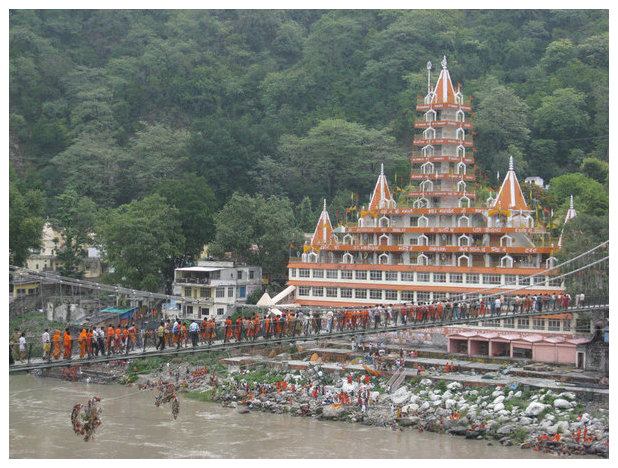 At a distance of 26.5 km from Rishikesh and 50 km from Haridwar, Neelkanth Mahadev Temple is an ancient Hindu temple situated at an altitude of 1330 m and is located in the Pauri Garhwal district of Uttarakhand. This is one of the popular temples in Uttarakhand state. At a distance of 26.5 km from Rishikesh and 50 km from Haridwar, Neelkanth Mahadev Temple is an ancient Hindu temple situated at an altitude of 1330 m and is located in the Pauri Garhwal district of Uttarakhand. This is one of the popular temples in Uttarakhand state.
Neelkanth Mahadev Temple is one of the most revered holy shrines dedicated to Lord Shiva. It is surrounded by dense forest and is adjacent to the mountain ranges of Nar-Narayan. The temple lies amidst the valleys of Manikoot, Brahmakoot and Vishnukoot and is located at the confluence of the rivers Pankaja and Madhumati.
According to Hindu mythology, this is the place where Lord Shiva consumed the poison Halahala that originated from the sea when Devas and Asuras churned the ocean in order to obtain Amrita. He stopped the poison in throat, due to which his neck turned blue. Thus, Lord Shiva is also known as Neelkanth, literally meaning The Blue Throated One.
|
Kunjapuri Devi Mandir (Near Rishikesh):
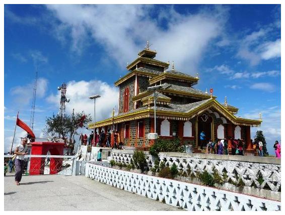 At a distance of 27.5 km from Rishikesh, Kunjapuri Devi Temple is located on a hillock at a distance of 11 km from Narendra Nagar. The temple is situated at an altitude of 1676 m and it is one of the most revered Hindu shrines in Uttarakhand. At a distance of 27.5 km from Rishikesh, Kunjapuri Devi Temple is located on a hillock at a distance of 11 km from Narendra Nagar. The temple is situated at an altitude of 1676 m and it is one of the most revered Hindu shrines in Uttarakhand.
Kunjapuri temple is dedicated to Goddess Parvati and is one of the three Siddha Peethas in Tehri district which were established by Jagadguru Shankaracharya. Other two Siddha Peethas in the district are Surkanda Devi and Chandrabadni. Situated on top of a hillock, this temple gives a breathtaking view of the mighty Himalayas and the holy towns of Haridwar and Rishikesh. Snow peaks of Garhwal Himalayas like Swarga Rohini, Gangotri, Banderpunch and Chaukhamba, can also be spotted from this temple.
|
Narendra Nagar (Near Rishikesh):
At a distance of 16 km from Rishikesh, Narendra Nagar is a city and a municipal board in Tehri Garhwal district of Uttarakhand. It is situated on the main Rishikesh-Gangotri-Yamunotri route. The town is situated at an elevation of 1,326 m above sea level.
The present town of Narendra Nagar came into existence in 1919, when Maharaja Narendra Shah of Tehri Garhwal moved his capital from Tehri to the picturesque location of Odathali or Narendra Nagar. The last Maharaja, Manabendra Shah took over the control of Tehri Garhwal in 1946, from Maharaja Narendra Shah. The province was eventually merged with the state of Uttar Pradesh shortly after India gained independence.
|
Neer Garh / Neer Gaddu Waterfall (Near Rishikesh):
At a distance of 9 km from Rishikesh Railway Station and 5 km from Lakshman Jhula, Neer Gaddu or Neer Garh Waterfall is a natural water fall situated on Rishikesh - Badrinath Highway in Uttarakhand.
Neer Gaddu Waterfall is a famous waterfall for small trek. The water flowing from natural rocky cliffs tempts the holidaymakers to take a cool dip in the narrow stream. The trekking to the waterfall is an adventurous activity as it involves walking through the jungle on narrow trails. This is a beautiful waterfall and is extremely refreshing to stand near the waterfall.
This is a two tier waterfall with two bathing pools. There is very small waterfall after 200 m trek from the road where visitors can also take bath in a small pool. Further 1.2 km trek will take you to the bigger and main waterfall which has a large pool.
|
Patna Waterfalls (Near Rishikesh):
At a distance of 13 km from Rishikesh Railway Station and 6.5 km from Lakshman Jhula, Patna Waterfall is located at Patna village on Neelkanth Temple Road in Uttarakhand.
|
White Water Rafting - Shivpuri (Near Rishikesh):
At a distance of 16 km from Rishikesh Railway Station, Shivpuri is a small town located on the Rishikesh - Bhadrinath Road. Shivpuri is famous for White Water Rafting apart from its ashrams and temples.
Shivpuri is also known for its numerous camps and as the major River Rafting destination in Rishikesh. At Shivpuri, tourists can indulge in a number of Activities like River Rafting, Camping, mountaineering and Jungle Trekking. Visitors will also have the opportunity of learning the techniques of yoga and meditation during their stay in Shivpuri.
|
White Water Rafting - Kaudiyala (Near Rishikesh):
At a distance of 38 km from Rishikesh and 22 km from Shivpuri, Kaudiyala is a small village located on Badrinath Road in Uttarakhand.
Situated at an altitude of 380 m on the banks of River Ganga, Kaudiyala is famous for White Water rafting and it is a beautiful camping site. The 36 km stretch of River Ganges from Kaudiyala till Rishikesh offers some of the world's most fun-filled and challenging Grade III and Grade IV river rapids along with a Grade V rapid. These rapids are termed as difficult, as they feature some serious obstacles to rafters sailing along.
Kaudiyala rafting is especially famous because this stretch includes a Grade V rapid which is the only grade V rapid on the Ganges. Kaudiyala rafting is not recommended to a group of first-time river rafters. The total time taken to complete the expedition is around 8 hours.
|
Rafting - Brahmapuri (Near Rishikesh):
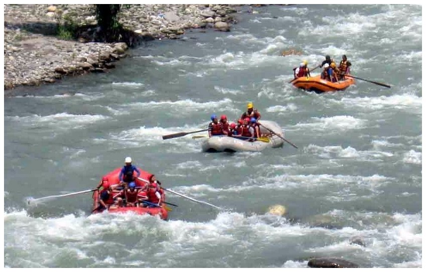 At a distance of 8.5 km from Rishikesh Railway Station, Brahmapuri Rafting Point is situated on Bhadrinath Road in Uttarakhand. It is one of the best places for adventure sports in Uttarakhand. This rafting stretch serves as the inaugural rafting trip every year in Rishikesh. The rafting trip is the first one to open and the last one to get closed each year. At a distance of 8.5 km from Rishikesh Railway Station, Brahmapuri Rafting Point is situated on Bhadrinath Road in Uttarakhand. It is one of the best places for adventure sports in Uttarakhand. This rafting stretch serves as the inaugural rafting trip every year in Rishikesh. The rafting trip is the first one to open and the last one to get closed each year.
The Brahmapuri rafting is one of the cost-effective and safe river rafting packages in Rishikesh. This stretch has around 4 rapids most of which can be classified as Grade I and Grade II. These are ideal for family rafting trips in Rishikesh and school groups. The 9 km long rafting stretch that starts from Brahmapuri takes about 2 hours which can be participated by anyone aged 8 years and above. The package includes Brahmapuri rafting trip and several fun activities like camping, bonfire, volleyball, cliff jumps, Body surfing, etc.
|
White Water Rafting - Marine Drive (Near Rishikesh):
At a distance of 16 km from Shivpuri and 32 km from Rishikesh Railway Station, Marine Drive River Rafting Camp is located near Byasi and is one of the most adventurous river rafting trips in Rishikesh.
This is a 25 km long rafting stretch starts from Marine drive near Byasi to Lakshman Jhula and takes about 4 hours. Marine Drive rafting package includes camping with all meals, bonfire snacks, rock climbing/rappelling and the 25 km Marine Drive Rafting stretch. The rafting stretch has around 12 rapids most of which can be classified as Grade III and Grade IV. Among these the major ones are the Three Blind Mice, Roller Coaster and the Golf Course rapids. The Marine drive rafting package is one of the most adventurous rafting packages in Rishikesh.
This rafting package includes Marine drive rafting and several fun activities like camping, bonfire, volleyball, cliff jumps, Body surfing, etc. This rafting package is ideal for persons having prior experience in rafting.
|
Garud Chatti Waterfall & Phool Chatti Waterfall (Near Rishikesh):
At a distance of 9 km from Rishikesh Railway Station and 4 km from Lakshman Jhula, Garud Chatti waterfall is situated at Neelkanth road near Rishikesh.
Garud Chatti waterfall is one of the hot spots, mainly among foreign tourists in Rishikesh. The waterfall is small but beautiful. This waterfall is most beautiful during the monsoons when the water flows in seven different levels. It is a pleasant place to visit and to spend a couple hours.
The trek route to Garud Chatti Waterfall starts around 3 km away from Lakshman Jhula on the Neelkanth Mandir Road. The trek starts from a temple dedicated to Garuda. Visitors need to trek for about 1.5 km from here to reach the waterfall.
|
Vasuki Tal (Near Kedarnath):
At a distance of 8 km from Kedarnath, Vasuki Tal or Vasuki Lake is an enchanting lake situated at an altitude of 4135 m in the beautiful hills of Kedarnath in Uttarakhand. It is also a famous place among Uttarakhand Treks.
Vasuki Tal is surrounding with very high mountains and provides beautiful view of several peaks of Himalayas. This is the lake where Lord Vishnu is believed to have bathed in ancient times. Crystal clear water flowing through the lake revealing the rock stacks inside is an amazing view in Vasuki Tal. This beautiful lake provides a charming view of the neighboring Chaukhamba peaks. There are several beautiful, colorful flowers around the Vasuki Tal and one of the famous flowers is Brahma Kamal. During winter the lake it is completely frozen.
|
Chorabari Tal / Gandhi Sarovar (Near Kedarnath):
At a distance of 3 km from Kedarnath, Chorabari Tal, also known as Gandhi Tal, is a beautiful lake produced from the Chorabari Bamak glacier.
Chorabari Tal is a small lake that holds crystal clear water. Perched at an altitude of 3,900 m above sea level, Gandhi Sarovar lies on the foot of Kedarnath and Kirthi Stambh peak. It offers magnificent views of the surrounding Himalayan peaks.
The original name of the lake is Kanti Sarovar. In the year 1948, some of Mahatma Gandhi's ashes were immersed here, after which it was renamed Gandhi Sarovar. According to mythology, this lake was the place where Lord Shiva imparted the knowledge of Yoga to the Saptrishis. There is a Bhairava Temple close to the glacier adjacent to a cliff known as Bhairava Jhamp. The cliff was a place where devotees jumped off, believing that it would bring them mukti. The practice was banned by the British administration in the 19th century.
|
Chandrashila (Near Kedarnath):
At a distance of 1 km from Tungnath, 4.5 km from Chopta, 32 km from Ukhimath, 74 km from Rudraprayag and 89 km from Kedarnath, Chandrashila is the summit of the Chandranath Parvat on which Tungnath Temple of Panch Kedar is located. It is situated at a height of 4000 m above sea level. This is one of the most popular Tourist places in Uttarakhand.
According to the mythology, Chandrashila peak is believed to be the spot where Lord Rama meditated after killing Raavana. Rama came to Chandrashila to meditate and pray Lord Shiva to cleanse the sins of killing Raavana. Local legend also states that Chandradev, the Moon God, had performed penance at Chandrashila for years.
|
Triyuginarayan Temple (Near Kedarnath):
At a distance of 27 km from Kedarnath, 13 km from Gaurikund and 10 km from Sonprayag, Triyugi Narayan Temple is an ancient Hindu temple situated in Triyuginarayan village in Rudraprayag District of Uttarakhand. It lies at an altitude of 1980 m.
Triyugi Narayan Temple is dedicated to Lord Vishnu. The present temple, believed to have been built by Adi Shankaracharya. This temple offers panoramic views of snowcapped mountains with beauty of Garhwal hill region. The word Triyuginarayan is formed of three words tri means three, yugi denotes Yuga and Narayan is another name of Vishnu.
This place is associated with marriage of Lord Shiva and goddess Parvati. According to mythology, Triyuginarayan is the capital of Himavat. It was the venue of the celestial marriage of Shiva and Parvati. Lord Vishnu as Parvati's brother did kanyadaan and Lord Brahma was the priest of the wedding. Brahma Shila in front of the temple also marks the exact place of the wedding.
|
Deoria Tal (Near Kedarnath):
At a distance of 16 km from Ukhimath, 59 km from Gaurikund, 73 km from Kedarnath and 56 km from Rudraprayag, Deoria Tal is a beautiful mountain lake located near Saari village in Uttarakhand. It lies at an altitude of 2438 m about 3 km uphill trek from Saari on Ukhimath-Chopta road. It is a popular destination for trekking near Badrinath and also one of the top Uttarakhand places to visit for trekking.
The lake is surrounded by thick forests and the crystal clear water of this lake offers the reflection of the mighty Chaukhamba peak. It offers a splendid view of Chopta, Tungnath and Chandrashila peak to the right and the breathtaking view of mountains like Chaukhamba, Nilkantha, Bandarpunch, Kedar Range, and Kalanag to the left. It is located in the Nanda Devi Biodiversity Park and has an abundance of colorful birds and mammals.
According to the Hindu mythology, Devas used to bath in this lake hence the name. The lake is also .....
|
|